Other ID: FERL9829
Status: Completed
Organization(s): USGS, Woods Hole Coastal and Marine Science Center
Funding Program(s):
Principal Investigator(s): Page Valentine
Affiliate Investigator(s): NOAA
Information Specialist(s): Page Valentine
Data Type(s): Seismics: Sub Bottom Profiler, Imagery: Photo, Imagery: Video, Sampling: Geology, Location-Elevation: Navigation
Scientific Purpose/Goals: High-resolution seismic survey; sampling, video, and photos of sea bed.
Vehicle(s):
Start Port/Location: Woods Hole, MA
End Port/Location: Boston, MA
Start Date: 1998-09-30
End Date: 1998-10-18
Equipment Used: Datasonics SST 220 sub-bottom 3.5k, SeaBOSS, P-code GPS
Information to be Derived:
Summary of Activity and Data Gathered: Collected 300 km of chirp sub-bottom sonar; 98 photo/video stations; and 60 sediment samples. Lost 6.5 days to bad weather.
Staff: Dann Blackwood, Thomas O'Brien, Page Valentine, Kenneth F. Parolski, Jessica Baker, Tanya Unger, Nancy K. Soderberg, Alex Robinson
Affiliate Staff:
J. Lindholm
NOAA/NURC
Notes: Project = Stellwagen Bank NMS Mapping Project, Stellwagen Bank NMS Mapping Project
Information from Foghorn: high-resolution seismics (datasonics chirp sonar);new blue winch w/ video-photo grab;P-code navigation;geolink software;deck van;
Location:
Stellwagen Bank NMS region, United States, North America, North Atlantic;
| Boundaries | |||
|---|---|---|---|
| North: 42.8 | South: 42.083 | West: -70.6 | East: -70.033 |
Platform(s):
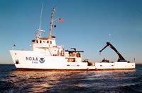 Ferrel |
Valentine, P.C., Baker, J.L., Unger, T.S., Scully, L.A., and Fuller, S.J., 2005, Sea floor image maps showing topography, sun-illuminated topography, backscatter intensity, ruggedness, slope, and the distribution of boulder ridges and bedrock outcrops in the Stellwagen Bank National Marine Sanctuary region off Boston, Massachusetts: U.S. Geological Survey Scientific Investigations Map 2840, https://doi.org/10.3133/sim2840.
Valentine, P.C., and Cross, V.A., 2023, Geospatial datasets of seabed topography, sediment mobility, and the distribution of geologic substrates in quadrangle 5 of the Stellwagen Bank National Marine Sanctuary region offshore of Boston, Massachusetts: U.S. Geological Survey data release, https://doi.org/10.5066/P9W9BN3S.
Valentine, P.C., and Gallea, L.B., 2015, Seabed maps showing topography, ruggedness, backscatter intensity, sediment mobility, and the distribution of geologic substrates in quadrangle 6 of the Stellwagen Bank National Marine Sanctuary region offshore of Boston, Massachusetts: U.S. Geological Survey Scientific Investigations Map 3341, 10 sheets, scale 1:25,000, and 21-p. pamphlet, https://doi.org/10.3133/sim3341.
Valentine, P.C., Gallea, L.B., Blackwood, D.S., and Twomey, E.R., 2010, Seabed photographs, sediment texture analyses, and sun-illuminated sea floor topography in the Stellwagen Bank National Marine Sanctuary region off Boston, Massachusetts: U.S. Geological Survey Data Series 469, available at https://doi.org/10.3133/ds469.
| Survey Equipment | Survey Info | Data Type(s) | Data Collected |
|---|---|---|---|
| Datasonics SST 220 sub-bottom 3.5k | --- | Sub Bottom Profiler | |
| SeaBOSS | --- | Surveys (biological) Experiments (biological) Species ID Photo Video Geology Biology | 1998-029-FA-SC-001 (GRAB samples) 1998-029-FA-PH-001 (CD ROM disk of BOTTOMPHOTO STELL JD277, BOTTOMPHOTO STELL JD278, BOTTOMPHOTO STELL JD280, BOTTOMPHOTO STELL JD286, BOTTOMPHOTO STELL JD287, BOTTOMPHOTO STELL JD288, ) |
| P-code GPS | --- | Navigation |
