Other ID: none
Status: Completed
Organization(s): USGS, Woods Hole Coastal and Marine Science Center
Funding Program(s):
Principal Investigator(s): Uri Ten Brink
Affiliate Investigator(s):
Information Specialist(s): Gregory Miller
Data Type(s): Location-Elevation: Navigation, Seismics: Ocean Bottom Seismometer
Scientific Purpose/Goals: Test recording of earthquakes by ocean bottom seismometers.
Vehicle(s):
Start Port/Location: Long Beach, CA
End Port/Location: Long Beach, CA
Start Date: 1998-10-15
End Date: 1998-10-29
Equipment Used: GPS (wh), Ocean Bottom Seismometer
Information to be Derived:
Summary of Activity and Data Gathered:
Staff: Gregory Miller, Uri Ten Brink, Philipp Molzer
Affiliate Staff:
Notes:
Location:
Los Angeles, California, United States, North America, North Pacific,
| Boundaries | |||
|---|---|---|---|
| North: 33.9 | South: 33.8 | West: -118.6 | East: -118.5 |
Platform(s):
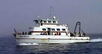 Sea Watch |
| Survey Equipment | Survey Info | Data Type(s) | Data Collected |
|---|---|---|---|
| GPS (wh) | --- | Navigation | |
| Ocean Bottom Seismometer | --- | Ocean Bottom Seismometer | 1998-034-FA-SE-001 (Digital tape(s) of OBS TEST RAW,NAV, ) |
