Other ID: none
Status: Completed
Organization(s): USGS, Woods Hole Coastal and Marine Science Center
Funding Program(s):
Principal Investigator(s): Peter W. Gill
Affiliate Investigator(s):
Information Specialist(s): Peter W. Gill
Data Type(s): Sampling: Chemistry, Location-Elevation: Navigation
Scientific Purpose/Goals: Collect bottom water samples.
Vehicle(s):
Start Port/Location: Pt. Allerton, Hull, MA
End Port/Location: Pt. Allerton, Hull, MA
Start Date: 1998-07-30
End Date: 1998-07-30
Equipment Used: Niskin bottle, Raytheon radar, Compass
Information to be Derived: Samples and chemical analysis;
Summary of Activity and Data Gathered: Station 3: Massachusetts Bay - 1 water sample 2 m off bottom; 1 water sample 2 m below surface. Station 8: Boston Harbor - 1 water sample 2 m off bottom. Main Coast Guard Base, Boston Harbor - 1 water sample 2 m off bottom in inlet between Coast Guard base and Lobster Building.
Staff: Peter W. Gill
Affiliate Staff:
Raja Ganeshram - Woods Hole Oceanographic Institution
Notes: Original Center People field contained: Peter Gill - mobilization, transportation, sampling at sea.
Location:
Boston Harbor, Massachusetts Bay, Massachusetts, United States, North America, North Atlantic;
| Boundaries | |||
|---|---|---|---|
| North: 42.35 | South: 42.2 | West: -71 | East: -70.9 |
Platform(s):
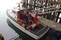 USCG 41 |
| Survey Equipment | Survey Info | Data Type(s) | Data Collected |
|---|---|---|---|
| Niskin bottle | --- | Chemistry | |
| Raytheon radar | --- | Navigation | |
| Compass | --- | Navigation |
