Other ID: MH29-99
Status: Completed
Organization(s): USGS, Woods Hole Coastal and Marine Science Center
Funding Program(s):
Principal Investigator(s): Michael Bothner
Affiliate Investigator(s):
Information Specialist(s): Frances Lightsom
Data Type(s): Environmental Data: Dissolved Oxygen, Imagery: Photo, Location-Elevation: Navigation, Sampling: Geology, Time Series: Mooring (physical oceanography)
Scientific Purpose/Goals: Exchange moorings at two locations and collect sediment cores at two long-term monitoring stations. We made measurements of oxygen profiles at the sediment stations. Water samples were collected for total suspended matter measurements at the surface and bottom at Station 3.
Vehicle(s):
Start Port/Location: U.S. Coast Guard Base, Boston, MA
End Port/Location: U.S. Coast Guard Base, Boston, MA
Start Date: 1999-02-10
End Date: 1999-02-11
Equipment Used: Van Veen grab sampler, Slow corer, Camera- deep sea, DGPS, Bottom platform, Oxygen profiling system from Sayles
Information to be Derived: Time series data; Samples and chemical analysis; Suspended sediment concentrations;
Summary of Activity and Data Gathered: Divers were not needed. All moorings were recovered without incident. K. von der Heydt tested the radio modem from the ship to a tower near Marshfield. Moorings recovered: 4 (#540, 541, 542 and 543 all deployed FA 98044 MARCUS HANNA Sep. 30 - Oct. 1, 1998). Moorings deployed: 4 (#551, 552 and 553, all recovered FA 99008 MARCUS HANNA May 11-12, 1999; #554 recovered FA 99040 CHRISTOPHER ANDREW May 26, 1999).
Staff: Dann Blackwood, Jonathan Borden, Michael Bothner, Bradford Butman, Jessica M. Cote, Brian Flynn, Peter W. Gill, Roger Hubbell, Marinna Martini, Richard Rendigs, Alex Robinson
Affiliate Staff:
Day 1: Lary Ball and Keith von der Heydt (WHOI). Day 2: Joanne Goudreau (WHOI).
Notes: Original Center People field contained: Day 1: Jonathan Borden, Mike Bothner, Dann Blackwood, Brad Butman, Jessica Cote, B. Flynn, Peter Gill, Marinna Martini, Richard Rendigs, Alex Robinson. Day 2: Mike Bothner, Dann Blackwood, B. Flynn, Peter Gill, Roger Hubbell, Richard Rendigs, Alex Robinson.
Project = The Massachusetts Bay Experiment, The Massachusetts Bay Experiment
Information from Foghorn: Standard array of mooring instruments and sediment traps for Massachusetts Bay project, hydraulically damped corer in gravity core mode, Teflon coated Van Veen grab (not used);
Location:
Massachusetts Bay, Massachusetts, United States, North America, North Atlantic,
| Boundaries | |||
|---|---|---|---|
| North: 42.56762087 | South: 42.22333876 | West: -71.0294 | East: -70.51983643 |
Platform(s):
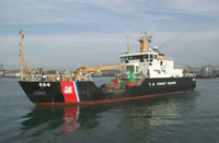 Marcus Hanna |
Bothner, M.H., and Butman, Bradford (eds.), 2007, Processes influencing the transport and fate of contaminated sediments in the coastal ocean—Boston Harbor and Massachusetts Bay: U.S. Geological Survey Circular 1302, 89 p., https://doi.org/10.3133/cir1302.
Butman, B., Alexander, P.S., and Bothner, M.H., 2004, Time-series photographs of the sea floor in western Massachusetts Bay—June 1998 to May 1999: U.S. Geological Survey Data Series 96, https://doi.org/10.3133/ds96.
Butman, B., Bothner, M.H., Alexander, P.S., Lightsom, F.L., Martini, M.A., Gutierrez, B.T., and Strahle, W.S., 2004, Long-term oceanographic observations in western Massachusetts Bay offshore of Boston, Massachusetts; data report for 1989-2002: U.S. Geological Survey Digital Data Series DDS-74, Version 2.0, DVD-ROM, URL: https://doi.org/10.3133/ds74_v2.
Butman, B., Dalyander, P.S., Bothner, M.H., Borden, J., Casso, M.A., Gutierrez, B.T., Hastings, M.E., Lightsom, F.L., Martini, M.A., Montgomery, E.T., Rendigs, R.R., and Strahle, W.S., 2009, Long-term oceanographic observations in Massachusetts Bay, 1989 - 2006 (version 3): U.S. Geological Survey Data Series 74, https://doi.org/10.3133/ds74.
Butman, B., Dalyander, P.S., Bothner, M.H., and Lange, W.N., 2008, Time-series photographs of the sea floor in western Massachusetts Bay, 1996 - 2005: U.S. Geological Survey Data Series 266, https://doi.org/10.3133/ds266.
Warner, J.C., Butman, B., and Dalyander, P. S., 2008, Storm-driven sediment transport in Massachusetts Bay: Continental Shelf Research, v. 28 no. 2, doi: 10.1016/j.csr.2007.08.008.
Warner, J.C., Sherwood, Christopher R., Signell, Richard P., Harris, Courtney K., and Arango, Hernan G., 2008, Development of a three-dimensional, regional, coupled wave, current, and sediment-transport model: Computers and Geosciences, v. 34 no. 10, doi: 10.1016/j.cageo.2008.02.012.
| Survey Equipment | Survey Info | Data Type(s) | Data Collected |
|---|---|---|---|
| Van Veen grab sampler | --- | Geology | |
| Slow corer | --- | Geology | 1999-007-FA-SC-001 (CORE samples) |
| Camera- deep sea | --- | Photo | 1999-007-FA-PH-001 (film collection of TRIPOD 552; 19990210-19990511) 1999-007-FA-PH-002 (DVD ROM disk of MASS BAY BOTHNER NOTEBOOKS, TRIPOD 552 BOSTON 1-190, TRIPOD 552 BOSTON 191-377, TRIPOD 552 BOSTON 378-520, ) |
| DGPS | --- | Navigation | |
| Bottom platform | --- | Mooring (physical oceanography) | 1999-007-FA-OM-002 (Western Mass Bay mooring data) 1999-007-FA-OM-001 (DVD ROM disk of MASS BAY BOTHNER NOTEBOOKS, TRIPOD 552 BOSTON 1-190, TRIPOD 552 BOSTON 191-377, TRIPOD 552 BOSTON 378-520, ) |
| Oxygen profiling system from Sayles | --- | Dissolved Oxygen |
