Other ID: MH34-00; IB H-4-00-MY
Status: Completed
Organization(s): USGS, Woods Hole Coastal and Marine Science Center
Funding Program(s):
Principal Investigator(s): Michael Bothner
Affiliate Investigator(s): William Martin - WHOI
Information Specialist(s): Michael Casso, Frances Lightsom
Data Type(s): Environmental Data: Dissolved Oxygen, Geochemical: Experiments (geochemical), Imagery: Photo, Imagery: Video, Sampling: Geology, Time Series: Mooring (physical oceanography)
Scientific Purpose/Goals: Three day trips were completed. Day 1: Exchanged moorings off Boston and Scituate. Day 2: Collected sediment cores with the new hydraulically damped corer at Stations 2, 3 and 3b (near the benthic chamber deployment site). Deployed and recovered oxygen profiler - 2 times at Station 3 and once at Station 2. Recovered one benthic chamber by SCUBA divers. The second chamber was not found. Day 3: An attempt was made to recover the lost slow corer from location east of Stellwagen Bank at 200 m water depth. A three grapling hook assembly (on an 8-foot spreader) was used with a camera attached to the middle hook. Dann Blackwood arranged 6 submersible flashlights on the central hook which did a good job illuminating to the side and bottom. The whole assemblage was lowered on half-inch tenex rope (breaking strength about 11,000 lbs). Approximately 2 hours were spent on and around the last known position of the core. It was not seen in the camera, nor was it hooked during the dragging operation.
Vehicle(s):
Start Port/Location: Boston, MA
End Port/Location: Portland, ME
Start Date: 2000-09-26
End Date: 2000-09-28
Equipment Used: Oxygen profiling system from Sayles, Benthic Chambers, Van Veen grab sampler, Slow corer, Osprey camera system, Camera- deep sea, Digital camera, Bottom platform
Information to be Derived:
Summary of Activity and Data Gathered: Lary Ball was the lead diver. Richard Rendigs and Dann Blackwood also made a dive to recover the second benthic chamber. The marker float for this chamber was missing when we arrived on station. A second marker float drifted between the time of initial confirmation of the chamber location (based on the diver-held acoustic range finder) and the actual dive. As a result, the chamber was not recovered. Moorings recovered: 4 (#624, 625, 626 and 627, all deployed FA 00003 MARCUS HANNA May 9-10, 2000). Moorings deployed: 5 (#630, 631, 632 and 634, all deployed FA 01022 MARCUS HANNA Feb. 13-14, 2001; #633 recovered FA 01051 CHRISTOPHER ANDREW Mar. 20, 2001).
Staff: Dann Blackwood, Jonathan Borden, Michael Bothner, Michael Casso, Roger Hubbell, Marinna Martini, Jenna Munson, Joseph S. Newell, Andree Ramsey, Richard Rendigs, David Walsh
Affiliate Staff:
Scientists and divers from WHOI: William Martin
Joanne Goudreau. Divers: Lary Ball
Thomas Bolmer
Ellen Montgomery
Jay Sisson.
Notes: Project = The Massachusetts Bay Experiment, The Massachusetts Bay Experiment
Location:
Massachusetts Bay, Scituate, Massachusetts, United States, North America, North Atlantic;
| Boundaries | |||
|---|---|---|---|
| North: 42.39720657 | South: 42.15344992 | West: -70.84061259 | East: -70.6240547 |
Platform(s):
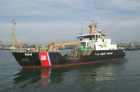 Marcus Hanna |
Bothner, M.H., and Butman, Bradford (eds.), 2007, Processes influencing the transport and fate of contaminated sediments in the coastal ocean—Boston Harbor and Massachusetts Bay: U.S. Geological Survey Circular 1302, 89 p., https://doi.org/10.3133/cir1302.
Butman, B., Alexander, P.S., and Bothner, M.H., 2004, Time-Series photographs of the sea floor in western Massachusetts Bay—May to September 1999; May to September 2000; and October 2001 to February 2002: U.S. Geological Survey Data Series 97, https://doi.org/10.3133/ds97.
Butman, B., Bothner, M.H., Alexander, P.S., Lightsom, F.L., Martini, M.A., Gutierrez, B.T., and Strahle, W.S., 2004, Long-term oceanographic observations in western Massachusetts Bay offshore of Boston, Massachusetts; data report for 1989-2002: U.S. Geological Survey Digital Data Series DDS-74, Version 2.0, DVD-ROM, URL: https://doi.org/10.3133/ds74_v2.
Butman, B., Dalyander, P.S., Bothner, M.H., Borden, J., Casso, M.A., Gutierrez, B.T., Hastings, M.E., Lightsom, F.L., Martini, M.A., Montgomery, E.T., Rendigs, R.R., and Strahle, W.S., 2009, Long-term oceanographic observations in Massachusetts Bay, 1989 - 2006 (version 3): U.S. Geological Survey Data Series 74, https://doi.org/10.3133/ds74.
Butman, B., Dalyander, P.S., Bothner, M.H., and Lange, W.N., 2008, Time-series photographs of the sea floor in western Massachusetts Bay, 1996 - 2005: U.S. Geological Survey Data Series 266, https://doi.org/10.3133/ds266.
Warner, J.C., Butman, B., and Dalyander, P. S., 2008, Storm-driven sediment transport in Massachusetts Bay: Continental Shelf Research, v. 28 no. 2, doi: 10.1016/j.csr.2007.08.008.
Warner, J.C., Sherwood, Christopher R., Signell, Richard P., Harris, Courtney K., and Arango, Hernan G., 2008, Development of a three-dimensional, regional, coupled wave, current, and sediment-transport model: Computers and Geosciences, v. 34 no. 10, doi: 10.1016/j.cageo.2008.02.012.
| Survey Equipment | Survey Info | Data Type(s) | Data Collected |
|---|---|---|---|
| Oxygen profiling system from Sayles | --- | Dissolved Oxygen | |
| Benthic Chambers | --- | Experiments (geochemical) | |
| Van Veen grab sampler | --- | Geology | |
| Slow corer | --- | Geology | 2000-004-FA-SC-001 (CORE samples) |
| Osprey camera system | --- | Photo Video | |
| Camera- deep sea | --- | Photo | 2000-004-FA-PH-001 (film collection of TRIPOD 632; 20000926-20010213) |
| Digital camera | --- | Photo | 2000-004-FA-PH-002 (Deck photos of field activity operations) |
| Bottom platform | --- | Mooring (physical oceanography) | 2000-004-FA-OM-001 (Western Mass Bay mooring data) |
