Other ID: AST-0800; IB A-70-00-CD
Status: Completed
Organization(s): USGS, Woods Hole Coastal and Marine Science Center
Funding Program(s):
Principal Investigator(s): Michael Bothner
Affiliate Investigator(s):
Information Specialist(s): Michael Casso
Data Type(s): Location-Elevation: Navigation, Sampling: Geology, Sampling: Biology, Imagery: Photo, Imagery: Video
Scientific Purpose/Goals: Collect cores at long-term monitoring stations in Cape Cod Bay. This work supports the Outfall Monitoring Program and is scheduled on short notice to collect samples before the outfall begins on September 6, 2000.
Vehicle(s):
Start Port/Location: Woods Hole, MA
End Port/Location: Woods Hole, MA
Start Date: 2000-08-17
End Date: 2000-08-18
Equipment Used: DGPS, Grab sampler, Osprey camera system, Slow corer
Information to be Derived:
Summary of Activity and Data Gathered: Hydro wire (3/16 inch) was used at Station 8 where water depth is 200m. This wire parted on the second deployment of the slow corer. Although the wire looked good and was tested (at the bitter end) and found to be of rated strength (3500 ?), it parted on the return trip from the bottom on the second cast. No evidence for a kink or a problem with the shieve. I learned later that the wire was at least 10 years old (predated Olmstead) so perhaps there was hidden corrosion. Next time, insist on a safety factor of 5 when lowering equipment to the bottom. Collected cores at Stations 6 and 7. Collected 3 Van Veen grab samples at Station 8. Samples from all 3 stations were gamma counted for radio-isotopes.
Staff: Michael Bothner, Richard Rendigs, Michael Casso
Affiliate Staff:
M. Santos
Notes: Original Center People field contained: Cruise participants: Mike Bothner, M. Casso, R. Rendigs, M. Santos.
Project = The Massachusetts Bay Experiment, The Massachusetts Bay Experiment
Location:
Cape Cod Bay, Massachusetts, United States, North America, North Atlantic,
| Boundaries | |||
|---|---|---|---|
| North: 42.5 | South: 41.8 | West: -70.7 | East: -69.9 |
Platform(s):
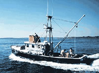
 Asterias |
Bothner, M.H., and Butman, Bradford (eds.), 2007, Processes influencing the transport and fate of contaminated sediments in the coastal ocean—Boston Harbor and Massachusetts Bay: U.S. Geological Survey Circular 1302, 89 p., https://doi.org/10.3133/cir1302.
| Survey Equipment | Survey Info | Data Type(s) | Data Collected |
|---|---|---|---|
| DGPS | --- | Navigation | |
| Grab sampler | --- | Biology Geology | 2000-070-FA-SC-001 (CORE, GRAB samples) |
| Osprey camera system | --- | Photo Video | |
| Slow corer | --- | Geology | 2000-070-FA-SC-002 (CORE, GRAB samples) |