Other ID: MH35-01; IB H-2-01-MY
Status: Completed
Organization(s): USGS, Woods Hole Coastal and Marine Science Center
Funding Program(s):
Principal Investigator(s): Michael Bothner
Affiliate Investigator(s):
Information Specialist(s): Michael Casso, Frances Lightsom
Data Type(s): Environmental Data: Dissolved Oxygen, Geochemical: Surveys (geochemical), Imagery: Photo, Imagery: Video, Location-Elevation: Navigation, Sampling: Geology, Time Series: Mooring (physical oceanography)
Scientific Purpose/Goals: Exchange moorings, collect sediment samples for long-term monitoring and for analysis of pore water, and deploy oxygen profiler.
Vehicle(s):
Start Port/Location: U.S. Coast Guard Base, Boston, MA
End Port/Location: U.S. Coast Guard Base, Boston, MA
Start Date: 2001-02-13
End Date: 2001-02-14
Equipment Used: Oxygen profiling system from Sayles, Submersible pumps, DGPS, Slow corer, Video camera - deep sea, Digital camera, Camera- deep sea, Bottom platform
Information to be Derived:
Summary of Activity and Data Gathered: This was cruise #35 for this program. The subsurface mooring at Scituate did not come up. One release was dead, the other talked but would not release. One NOPP tripod at Scituate also would not come up. Plans for diving from the CHRISTOPHER ANDREW are underway. Moorings recovered: 5 (#630, 631, 632 and 634, all deployed FA 00004 MARCUS HANNA Sep. 26-28, 2000; #636 deployed FA 00085 CHRISTOPHER ANDREW Nov. 14, 2000). Moorings deployed: 4 (#637, 638 and 639, all recovered FA 01023 MARCUS HANNA May 23-24, 2001; #640 recovered FA 01061 CHRISTOPHER ANDREW Jun. 20, 2001).
Staff: Dann Blackwood, Jonathan Borden, Michael Bothner, Michael Casso, Jenna Munson, Joseph S. Newell, Andree Ramsey, Richard Rendigs, David Walsh
Affiliate Staff:
J. Moore; Joanne Goudreau
Linda Kalnejais
Jennifer Morford (WHOI)
Notes: Original Center People field contained: Jonathan Borden, Mike Bothner, Dann Blackwood, Michael Casso, J. Moore, Richard Rendigs, David Walsh, Jenna Munson, Andree Ramsey (sea going scientists); Joseph Newell (Mobilization and transportation).
Project = The Massachusetts Bay Experiment, The Massachusetts Bay Experiment
Location:
Massachusetts Bay, Scituate, Massachusetts, United States, North America, North Atlantic;
| Boundaries | |||
|---|---|---|---|
| North: 42.39627692 | South: 42.37411613 | West: -70.83675109 | East: -70.8069059 |
Platform(s):
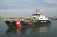 Marcus Hanna |
Bothner, M.H., and Butman, Bradford (eds.), 2007, Processes influencing the transport and fate of contaminated sediments in the coastal ocean—Boston Harbor and Massachusetts Bay: U.S. Geological Survey Circular 1302, 89 p., https://doi.org/10.3133/cir1302.
Butman, B., Bothner, M.H., Alexander, P.S., Lightsom, F.L., Martini, M.A., Gutierrez, B.T., and Strahle, W.S., 2004, Long-term oceanographic observations in western Massachusetts Bay offshore of Boston, Massachusetts; data report for 1989-2002: U.S. Geological Survey Digital Data Series DDS-74, Version 2.0, DVD-ROM, URL: https://doi.org/10.3133/ds74_v2.
Butman, B., Dalyander, P.S., Bothner, M.H., Borden, J., Casso, M.A., Gutierrez, B.T., Hastings, M.E., Lightsom, F.L., Martini, M.A., Montgomery, E.T., Rendigs, R.R., and Strahle, W.S., 2009, Long-term oceanographic observations in Massachusetts Bay, 1989 - 2006 (version 3): U.S. Geological Survey Data Series 74, https://doi.org/10.3133/ds74.
Butman, B., Dalyander, P.S., Bothner, M.H., and Lange, W.N., 2008, Time-series photographs of the sea floor in western Massachusetts Bay, 1996 - 2005: U.S. Geological Survey Data Series 266, https://doi.org/10.3133/ds266.
Warner, J.C., Butman, B., and Dalyander, P. S., 2008, Storm-driven sediment transport in Massachusetts Bay: Continental Shelf Research, v. 28 no. 2, doi: 10.1016/j.csr.2007.08.008.
Warner, J.C., Sherwood, Christopher R., Signell, Richard P., Harris, Courtney K., and Arango, Hernan G., 2008, Development of a three-dimensional, regional, coupled wave, current, and sediment-transport model: Computers and Geosciences, v. 34 no. 10, doi: 10.1016/j.cageo.2008.02.012.
| Survey Equipment | Survey Info | Data Type(s) | Data Collected |
|---|---|---|---|
| Oxygen profiling system from Sayles | --- | Dissolved Oxygen | |
| Submersible pumps | --- | Surveys (geochemical) | |
| DGPS | --- | Navigation | |
| Slow corer | --- | Geology | 2001-022-FA-SC-001 (CORE samples) |
| Video camera - deep sea | --- | Video | |
| Digital camera | --- | Photo | 2001-022-FA-PH-002 (Deck photos of field activity operations) |
| Camera- deep sea | --- | Photo | 2001-022-FA-PH-001 (film collection of TRIPOD 638; 20010213-20010524) |
| Bottom platform | --- | Mooring (physical oceanography) | 2001-022-FA-OM-001 (Western Mass Bay mooring data) |
