Other ID: none
Status: Completed
Organization(s): USGS, Woods Hole Coastal and Marine Science Center
Funding Program(s):
Principal Investigator(s): William Schwab
Affiliate Investigator(s): Paul Gayes (Coastal Carolina University)
Information Specialist(s): Jane Denny
Data Type(s): Imagery: Photo, Location-Elevation: Navigation, Sonar: Sidescan, Sonar: Single Beam
Scientific Purpose/Goals: Map the shoreface off north Myrtle Beach using sidescan sonar, interferometric bathymetry, and SUBSCAN sub-bottom system.
Vehicle(s):
Start Port/Location: Myrtle Beach, SC
End Port/Location: Myrtle Beach, SC
Start Date: 2002-05-01
End Date: 2002-05-22
Equipment Used: DGPS, Digital camera, Edgetech DF-1000 sidescan sonar, Echosounder
Information to be Derived:
Summary of Activity and Data Gathered: Sidescan-sonar, swath bathymetry, and high-resolution chirp sub-bottom data were collected within the nearshore region off the coast of Myrtle Beach, SC (within 1 km of the shoreline).
Staff: Wayne Baldwin, Jane Denny, David Nichols, William Schwab, Charles Worley
Affiliate Staff:
Paul Gayes (Coastal Carolina University)
Neal Driscoll (Scripps)
Notes: Original Center People field contained: Bill Schwab (co-PI), Jane Denny (Data Processing), Dave Nichols (Electronics Technician), Chuck Worley (Electronics Technician), Wayne Baldwin (Watch Stander).
Location:
Myrtle Beach, South Carolina, United States, North America, North Atlantic;
| Boundaries | |||
|---|---|---|---|
| North: 33.85673153 | South: 33.42914916 | West: -79.11499318 | East: -78.53178448 |
Platform(s):
 Coastal II |
Baldwin, W.E., Denny, J.F., Schwab, W.C., Gayes, P.T., Morton, R., and Driscoll, N.W., 2007, Geologic framework studies of South Carolina’s Long Bay from Little River Inlet to Winyah Bay, 1999–2003: Geospatial Data Release: U.S. Geological Survey Open-File Report 2005-1346, DVD-ROM, https://doi.org/10.3133/ofr20051346.
Baldwin, W.E., Morton, R.A., Denny, J.F., Dadisman, S.V., Schwab, W.C., Gayes, P.T., and Driscoll, N.W., 2004, Maps showing the stratigraphic framework of South Carolina's Long Bay from Little River to Winyah Bay: U.S. Geological Survey Open-File Report 2004-1013, https://doi.org/10.3133/ofr20041013.
Barnhardt, W.A. (ed.), 2009, Coastal change along the shore of northeastern South Carolina—the South Carolina coastal erosion study: U.S. Geological Survey Circular 1339, 77 p., https://doi.org/10.3133/cir1339.
Denny, J.F., Baldwin, W.E., Schwab, W.C., Gayes, P.T., Morton, R., and Driscoll, N.W., 2007, Morphology and texture of modern sediments on the inner shelf of South Carolina's Long Bay from Little River Inlet to Winyah Bay: U.S. Geological Survey Open-File Report 2005-1345, https://doi.org/10.3133/ofr20051345.
Denny, J.F., Schwab, W.C., Baldwin, W.E., Barnhardt, W.A., Gayes, P.T., Morton, R.A., Warner, J.C., Driscoll, N.W., and Voulgaris, G., 2013, Holocene sediment distribution on the Long Bay Inner Continental Shelf, between Little River Inlet to Winyah Bay-- Implications to the regional sediment budget and shoreline response: Continental Shelf Research, vol. 56, https://doi.org/10.1016/j.csr.2013.02.004.
Barnhardt, W.A. (ed.), 2009, Coastal change along the shore of northeastern South Carolina—the South Carolina coastal erosion study: U.S. Geological Survey Open-File Report 2008-1206, URL: https://doi.org/10.3133/ofr20081206.
| Survey Equipment | Survey Info | Data Type(s) | Data Collected |
|---|---|---|---|
| DGPS | --- | Navigation | |
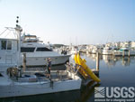
| Digital camera | --- | Photo | 2002-011-FA-PH-001 (Deck photos of field activity operations) |
| Edgetech DF-1000 sidescan sonar | --- | Sidescan | Sidescan mosaic |
| Echosounder | --- | Single Beam | Bathymetry GIS data |
