Other ID: MK-0202; A-1-02-HW
Status: Completed
Organization(s): USGS, Woods Hole Coastal and Marine Science Center
Funding Program(s):
Principal Investigator(s): Michael Bothner
Affiliate Investigator(s): Mike Field, CMGP-Santa Cruz, CA
Information Specialist(s): Michael Casso, Frances Lightsom
Data Type(s): Environmental Data: CTD, Environmental Data: Temperature, Location-Elevation: Navigation, Sampling: Geology, Time Series: Mooring (physical oceanography)
Scientific Purpose/Goals: Final recovery of two 21-bottle time-series sediment traps. Recovery of ~14 suspended sediment tube traps. Collection of 2 1.75-inch ID push cores. Downloading of salinity and turbidity data. Perform a post-recovery turbidity calibration bucket test. Clean, dismantle, and ship time-series trap tripods back to Woods Hole. Ship all other gear back to Woods Hole.
Vehicle(s):
Start Port/Location: Kaunakakai, Molokai, HI
End Port/Location: Kaunakakai, Molokai, HI
Start Date: 2002-02-14
End Date: 2002-02-15
Equipment Used: Temperature and salinity, Sediment traps, GPS (wh), Push corer (wh), Bottom platform
Information to be Derived: Time series data; Samples and chemical analysis; Grain size analysis; Suspended sediment concentrations;
Summary of Activity and Data Gathered: All cruise objectives were met.
Staff: Michael Bothner, Michael Casso, Richard Rendigs
Affiliate Staff:
Mike Field (Chief Scientist and project chief)
Curt Storlazzi
Susie Cochran
and Josh Logan (at-sea scientists and divers); Hank Chezar was present to recover his underwater camera system.
Notes:
Location:
Kamiloloa, Pala'au, Hale Olono, Puko'o, Kamalo, Island of Molokai, Hawaii, United States, North America, North Pacific;
| Boundaries | |||
|---|---|---|---|
| North: 21.08705 | South: 21.03747 | West: -157.246 | East: -156.79369 |
Platform(s):
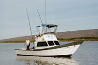
 Alyce C |
Bothner, M.H., Reynolds, R.L., Casso, M.A., Storlazzi, C.D., Field, M.E., 2008, Sediment mobility along Moloka`i's fringing coral reef; evidence from sediment traps; Chapter 19 in Field, M.E., Cochran, S.A., Logan, J.B., and Storlazzi, C.D., eds., The coral reef of south Moloka`i, Hawai`i; portrait of a sediment-threatened fringing reef: U.S. Geological Survey Scientific Investigations Report 2007-5101, doi: 10.3133/sir20075101.
Bothner, M.H., Reynolds, Richard L., Casso, Michael A., Storlazzi, Curt D., and Field, Michael E., 2006, Quantity, composition, and source of sediment collected in sediment traps along the fringing coral reef off Molokai, Hawaii: Marine Pollution Bulletin, v. 52 no. 9, doi: 10.1016/j.marpolbul.2006.01.008.
Field, M.E., Bothner, M.E., Chavez, P.S., Jr., Cochran, S.A., Jokiel, P.L., Ogston, A.S., Presto, M.K., Storlazzi, C.D., 2008, The effects of a Kona storm on the Moloka`i reef; November and December 2001; Chapter 21 of Field, M.E., Cochran, S.A., Logan, J.B., and Storlazzi C.D., eds., The coral reef of south Moloka`i, Hawai`i; portrait of a sediment-threatened fringing reef: U.S. Geological Survey Scientific Investigations Report 2007-5101, doi: 10.3133/sir20075101.
| Survey Equipment | Survey Info | Data Type(s) | Data Collected |
|---|---|---|---|
| Temperature and salinity | --- | CTD Temperature | |
| Sediment traps | --- | Geology | |
| GPS (wh) | --- | Navigation | |
| Push corer (wh) | --- | Biology Geology | 2002-027-FA-SC-001 (CORE samples) |
| Bottom platform | --- | Mooring (physical oceanography) |