Other ID: FERL0202
Status: Completed
Organization(s): USGS, Woods Hole Coastal and Marine Science Center
Funding Program(s):
Principal Investigator(s): Page Valentine
Affiliate Investigator(s):
Information Specialist(s): Page Valentine
Data Type(s): Imagery: Photo, Imagery: Video, Sampling: Geology
Scientific Purpose/Goals: Geologic studies of benthic habitats in the Stellwagen Bank NMS region.
Vehicle(s):
Start Port/Location: Woods Hole, MA
End Port/Location: Woods Hole, MA
Start Date: 2002-09-09
End Date: 2002-09-13
Equipment Used: Video camera - deep sea, Digital camera, SeaBOSS
Information to be Derived: Grain size analysis;
Summary of Activity and Data Gathered: Total of 24 stations occupied; 23 sediment samples; 23 video transects; 24 photo transects.
Staff: Dann Blackwood, Joseph S. Newell
Affiliate Staff:
Notes: Mobe on Sunday, Sep. 8, in Boston at Coast Guard base; depart Monday, Sep. 9; demobe Friday, Sep. 13, in Woods Hole. Original Center People field contained: At sea: D. Blackwood. Mob/demob: J. Newell - mobe in Boston at Coast Guard base on Sunday, 08 Sep.; demobe in Woods Hole, Friday am, 13 Sep.
Project = Stellwagen Bank Benthic Habitats Studies, Stellwagen Bank Benthic Habitats Studies
Location:
Stellwagen Bank, Massachusetts, United States, North America, Gulf of Maine, North Atlantic,
| Boundaries | |||
|---|---|---|---|
| North: 42.68097719 | South: 42.32944672 | West: -70.51375601 | East: -70.25924388 |
Platform(s):
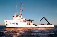 Ferrel |
Valentine, P.C., Gallea, L.B., Blackwood, D.S., and Twomey, E.R., 2010, Seabed photographs, sediment texture analyses, and sun-illuminated sea floor topography in the Stellwagen Bank National Marine Sanctuary region off Boston, Massachusetts: U.S. Geological Survey Data Series 469, available at https://doi.org/10.3133/ds469.
Valentine, P.C., Baker, J.L., Unger, T.S., Scully, L.A., and Fuller, S.J., 2005, Sea floor image maps showing topography, sun-illuminated topography, backscatter intensity, ruggedness, slope, and the distribution of boulder ridges and bedrock outcrops in the Stellwagen Bank National Marine Sanctuary region off Boston, Massachusetts: U.S. Geological Survey Scientific Investigations Map 2840, https://doi.org/10.3133/sim2840.
| Survey Equipment | Survey Info | Data Type(s) | Data Collected |
|---|---|---|---|
| Video camera - deep sea | --- | Video | |
| Digital camera | --- | Photo | 2002-029-FA-PH-001 (Deck photos of field activity operations) |
| SeaBOSS | --- | Surveys (biological) Experiments (biological) Species ID Photo Video Geology Biology | 2002-029-FA-SC-001 (GRAB samples) 2002-029-FA-PH-002 (Sea Bottom photos) |
