Other ID: Y-1-02-SC
Status: Completed
Organization(s): USGS, Woods Hole Coastal and Marine Science Center
Funding Program(s):
Principal Investigator(s): Marinna Martini
Affiliate Investigator(s): Marlene Noble
Information Specialist(s):
Data Type(s): Environmental Data: CTD, Sampling: Geology, Time Series: Mooring (physical oceanography)
Scientific Purpose/Goals: Subsurface mooring using ADCP and CT sensor
Vehicle(s):
Start Port/Location: Terminal Island, Los Angeles, CA
End Port/Location: Terminal Island, Los Angeles, CA
Start Date: 2002-10-14
End Date: 2002-10-14
Equipment Used: Piston corer, MicroCAT CTD Recorder, Bottom platform
Information to be Derived: Time series data;
Summary of Activity and Data Gathered: Deploy USGS Mooring #594 Sub-surface mooring at 60m water depth consisting of 7 SeaBird MicroCat conductivity/temperature sensors and 2 Brancker temperature sensors Deploy USGS Mooring #595 Trawl Resistent Bottom Mount (TRBM) with instruments: RDI Acoustic Doppler Current Profiler (ADCP) & MicroCat C/T sensor
Staff: Marlene Noble
Affiliate Staff:
Notes: This was a Menlo Park cruise with no Woods Hole personnel aboard. Original Center People field contained: Marlene Noble, Joanne Thede Ferreira, David Gonzales, Harold Williams.
Location:
CA
| Boundaries | |||
|---|---|---|---|
| North: 34.75 | South: 32.25 | West: -122.75 | East: -116.75 |
Platform(s):
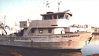 Yellowfin |
| Survey Equipment | Survey Info | Data Type(s) | Data Collected |
|---|---|---|---|
| Piston corer | --- | Geology | |
| MicroCAT CTD Recorder | --- | CTD | |
| Bottom platform | --- | Mooring (physical oceanography) | 2002-065-FA-OM-001 (mooring data) |
