Other ID: Y-3-04-SC
Status: Completed
Organization(s): USGS, Woods Hole Coastal and Marine Science Center
Funding Program(s):
Principal Investigator(s): Marinna Martini
Affiliate Investigator(s): Jingping Xu, CMG-MP
Information Specialist(s):
Data Type(s): Time Series: Mooring (physical oceanography)
Scientific Purpose/Goals: Recover moorings #735, 736, 738, 739 deployed in the Santa Clara River area.
Vehicle(s):
Start Port/Location: Ventura, CA
End Port/Location: Ventura, CA
Start Date: 2004-03-08
End Date: 2004-03-13
Equipment Used: Bottom platform
Information to be Derived: Time series data;
Summary of Activity and Data Gathered: Moorings recovered: 4 (#735, 736, 738 and 739, all deployed FA 04056 SEA WATCH Jan. 22, 2004; #737 washed ashore Feb. 26, 2004, recovered by tow truck).
Staff:
Affiliate Staff:
Jingping Xu
Joanne Ferreira
David Gonzales
Hal Williams
Notes: Menlo Park cruise; no WHSC personnel aboard.
Project = Santa Clara River Project, Santa Clara River Project
Location:
Ventura Harbor Boatyard, Santa Clara River, California, United States, North America, North Pacific;
| Boundaries | |||
|---|---|---|---|
| North: 34.25 | South: 34.2 | West: -119.3 | East: -119.25 |
Platform(s):
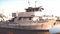 Yellowfin |
| Survey Equipment | Survey Info | Data Type(s) | Data Collected |
|---|---|---|---|
| Bottom platform | --- | Mooring (physical oceanography) |
