Other ID: Y-2-04-SC
Status: Completed
Organization(s): USGS, Woods Hole Coastal and Marine Science Center
Funding Program(s):
Principal Investigator(s): Marinna Martini
Affiliate Investigator(s): Joanne Ferreira, USGS-Menlo Park
Information Specialist(s):
Data Type(s): Time Series: Mooring (physical oceanography)
Scientific Purpose/Goals: Deploy mooring #761 at site B6.5 Palos Verdes Shelf.
Vehicle(s):
Start Port/Location: Palos Verdes, CA
End Port/Location: Palos Verdes, CA
Start Date: 2004-02-25
End Date: 2004-02-25
Equipment Used: Bottom platform
Information to be Derived: Time series data;
Summary of Activity and Data Gathered: Mooring deployed: 1 (#761 recovered FA 04060 SEA WATCH Apr. 6, 2004).
Staff:
Affiliate Staff:
USGS-Menlo Park: Joanne Ferreira
Ch. Sci.; Harold Williams
Notes: This is a Menlo Park cruise with no WHSC personnel aboard.
Project = EPA Palos Verdes Shelf, EPA Palos Verdes Shelf
Location:
Palos Verdes, Los Angeles, California, United States, North America, North Pacific;
| Boundaries | |||
|---|---|---|---|
| North: 33.68149668 | South: 33.66719523 | West: -118.3031728 | East: -118.28693334 |
Platform(s):
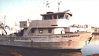 Yellowfin |
Wiberg, P.L., and Sherwood, Christopher R., 2008, Calculating wave-generated bottom orbital velocities from surface-wave parameters: Computers and Geosciences, v. 34 no. 10, doi: 10.1016/j.cageo.2008.02.010.
| Survey Equipment | Survey Info | Data Type(s) | Data Collected |
|---|---|---|---|
| Bottom platform | --- | Mooring (physical oceanography) | 2004-061-FA-OM-001 (mooring data) |
