Other ID: none
Status: Completed
Organization(s): USGS, Woods Hole Coastal and Marine Science Center
Funding Program(s):
Principal Investigator(s): Walter Barnhardt
Affiliate Investigator(s): Massachusetts Office of Coastal Zone Management
Information Specialist(s):
Data Type(s): Biological Field Study: Experiments (biological), Biological Field Study: Surveys (biological), Imagery: Photo, Imagery: Video, Location-Elevation: Navigation, Sampling: Biology, Sampling: Geology, Seismics: Sub Bottom Profiler, Sonar: Sidescan, Sonar: Sound Velocity, Visual Identification: Species ID, Sonar: Interferometric
Scientific Purpose/Goals: Sea floor mapping to: 1) support management of ocean resources; 2) clarify the post-glacial history of sea-level change in the region; 3) reconstruct coastal environments and quantifying rates of change over the last few thousand years; and 4) develop a sediment budget for the coastal system, which is experiencing chronic erosion.
Vehicle(s):
Start Port/Location: Woods Hole, MA
End Port/Location: Woods Hole, MA
Start Date: 2005-09-06
End Date: 2005-09-21
Equipment Used: SeaBOSS, Digital camera, Real Time Kinematic GPS, Edgetech chirp subbottom profiler 512i, SEA SWATHplus-M 234 kHz, Klein 595 100/500kHz sidescan sonar, Sensor - MVP30 (Odim)
Information to be Derived: Grain size analysis; Sea floor map; Bathymetric maps; high-resolution geologic maps;
Summary of Activity and Data Gathered: The new remotely operated vehicle (ROV) was deployed for the first time to successfully recover a sound-velocity profiler that was lost during a cast. We collected 100% coverage of sea floor with bathymetry and sidescan sonar data, approximately 1000 km of seismic reflection profiles, and grab samples and bottom photography/video at 93 stations. Cruise focused on nearshore areas in water depths of 5-25 m to complete the surficial mapping that was begun in 2003 (SAIC contract multibeam). Sub-bottom profiles were collected throughout entire study area in water depths of 5-90 m.
Staff: Brian Andrews, Walter Barnhardt, Emile Bergeron, William Danforth, Charles Worley
Affiliate Staff:
Seth Ackerman (data processor
MA CZM); Chris Hein (volunteer
Boston Univ.)
Notes: Original Center People field contained: Walter Barnhardt (PI); Charles Worley (marine tech); Brian Andrews (data processor); William Danforth (marine tech); Emile Bergeron (marine tech).
Project = Geologic mapping of the Massachusetts inner shelf, Geologic mapping of the Massachusetts inner shelf
Location:
Merrimack Embayment, Massachusetts, Gulf of Maine, United States, North America, North Atlantic;
| Boundaries | |||
|---|---|---|---|
| North: 42.88333 | South: 42.66667 | West: -70.8 | East: -70.58333 |
Platform(s):
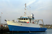
 Connecticut |
Barnhardt, W.A., Andrews, B.D., Ackerman, S.D., Baldwin, W.E., and Hein, C.J., 2009, High-resolution geologic mapping of the inner continental shelf—Cape Ann to Salisbury Beach, Massachusetts: U.S. Geological Survey Open-File Report 2007-1373, https://doi.org/10.3133/ofr20071373.
Pendleton, E.A., Baldwin, W.E., Barnhardt, W.A., Ackerman, S.D., Foster, D.S., Andrews, B.D., and Schwab, W.C., 2013, Shallow geology, seafloor texture, and physiographic zones of the Inner Continental Shelf from Nahant to northern Cape Cod Bay, Massachusetts: U.S. Geological Survey Open-File Report 2012–1157, 53 p., https://doi.org/10.3133/ofr20121157.
Pendleton, E.A., Barnhardt, W.A., Baldwin, W.E., Foster, D.S., Schwab, W.C., Andrews, B.D., and Ackerman, S.D., 2015, Sea-floor texture and physiographic zones of the inner continental shelf from Salisbury to Nahant, Massachusetts, including the Merrimack Embayment and Western Massachusetts Bay: U.S. Geological Survey Open-File Report 2015–1153, 36 p., 1 appendix, https://doi.org/10.3133/ofr20151153.
FAN 2005-005-FA has data viewable in the GeoMappApp/Virtual Ocean applications. To view this data in these applications go to http://www.geomapapp.org/ and http://www.virtualocean.org/. See the instructions for locating USGS data in these applications. You can also view the imagery created from the SEGY data at https://cmgds.marine.usgs.gov/images.php?cruise=2005-005-FA.
FAN 2005-005-FA has data viewable in the CMGP Video and Photograph Portal. View the data in this application here. See the instructions for working with this application.
| Title | Survey Equipment | Description |
|---|---|---|
| Cruise log | (document not focused on specific equipment) | Cruise Log: Excel spreadsheet kept by participants during cruise. Has a separate sheet for each piece of equipment, plus a sheet for files archived on DVD. |
| Survey Equipment | Survey Info | Data Type(s) | Data Collected |
|---|---|---|---|
| SeaBOSS | --- | Surveys (biological) Experiments (biological) Species ID Photo Video Geology Biology | 2005-005-FA-VD-002 (Downlooking Bottom Video (11-DVD's), duplicated 20090812. ) |
| Digital camera | --- | Photo | 2005-005-FA-PH-001 (Deck photos: 138 photos posted to the Data Archive web pages.) |
| Real Time Kinematic GPS | --- | Navigation | 2005-005-FA-LN-002 (Raw data 1-DVD archived Hypack Nav. from cruise and base station Navigation.) |
| Edgetech chirp subbottom profiler 512i | --- | Sub Bottom Profiler | 2005-005-FA-SE-002 (Raw SEGY data) |
| SEA SWATHplus-M 234 kHz | --- | Interferometric | Bathymetry GIS data (5-meter bathymetric grid of both the inshore and offshore survey areas in Esri 32-bit continuous floating point format.) 2005-005-FA-BA-001-01 (combined bathymetric depth grid of both inshore and offshore bathymetry) |
| Klein 595 100/500kHz sidescan sonar | --- | Sidescan | 2005-005-FA-SO-002 (Klein Sidescan Sonar Raw data set: (22-DVD's).) Sidescan mosaic (1-meter backscatter mosaic of the inshore survey area in 8-bit continuous unsigned integer GeoTIFF format) |
| Sensor - MVP30 (Odim) | --- | Sound Velocity |