Other ID: none
Status: Completed
Organization(s): USGS, Woods Hole Coastal and Marine Science Center
Funding Program(s):
Principal Investigator(s): Uri Ten Brink
Affiliate Investigator(s):
Information Specialist(s): PARTNER
Data Type(s): Seismics: Ocean Bottom Seismometer
Scientific Purpose/Goals: Pick up ocean bottom seismometers.
Vehicle(s):
Start Port/Location: San Juan, Puerto Rico
End Port/Location: St. George, Bermuda
Start Date: 2005-10-31
End Date: 2005-11-03
Equipment Used: Ocean Bottom Seismometer
Information to be Derived: Time series data;Morphology;
Summary of Activity and Data Gathered: Picked up 9 out of 10 OBSes. One OBS (#9; middle one north of the trench) did not respond despite 4 hours of efforts. Lithium battery pack of OBS #5 exploded on board ~36 hours after recovery following a slow undetected fire in the battery sphere. No injuries and no damage. Only partial data recovery from the remaining instruments because of programming error of the instruments prior to deployment.
Staff: Uri Ten Brink
Affiliate Staff:
Stephanie Ross - WMCG; Vic Bender - WHOI; Dave DuBois - WHOI
Notes: Data Curator: IRIS-DMC.
Location:
Puerto Rico trench, North America, North Atlantic;
| Boundaries | |||
|---|---|---|---|
| North: 20.5 | South: 18.83333 | West: -66 | East: -63.83333 |
Platform(s):
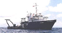 Weatherbird II |
| Survey Equipment | Survey Info | Data Type(s) | Data Collected |
|---|---|---|---|
| Ocean Bottom Seismometer | --- | Ocean Bottom Seismometer |
