Other ID: none
Status: Completed
Organization(s): USGS, Woods Hole Coastal and Marine Science Center
Funding Program(s):
Principal Investigator(s): Lawrence Poppe
Affiliate Investigator(s):
Information Specialist(s): Lawrence Poppe
Data Type(s): Biological Field Study: Experiments (biological), Biological Field Study: Surveys (biological), Imagery: Photo, Imagery: Video, Sampling: Biology, Sampling: Geology, Visual Identification: Species ID
Scientific Purpose/Goals: Ground truth NOAA multibeam survey H11079 of Great Round Shoal with bottom sampling and photography.
Vehicle(s):
Start Port/Location: Stage Harbor, Chatham, MA
End Port/Location: Stage Harbor, Chatham, MA
Start Date: 2006-07-24
End Date: 2006-07-27
Equipment Used: SeaBOSS, Digital camera
Information to be Derived:
Summary of Activity and Data Gathered: A total of 32 stations were occupied. Bottom photography was collected at all of the stations; sediment samples were collected at 28 of the stations.
Staff: Dann Blackwood, David Foster, Katherine McMullen, Lawrence Poppe
Affiliate Staff:
Notes: Original Center People field contained: Larry Poppe, Chief Scientist; Dave Foster, Ship Operator; Dann Blackwood, Photographer; Kate McMullen, Science Technician.
Project = Great Round Shoal, Great Round Shoal
Location:
Great Round Shoal, Massachusetts, United States, North America, North Atlantic;
| Boundaries | |||
|---|---|---|---|
| North: 41.44272638 | South: 41.39655656 | West: -70.0138092 | East: -69.81674194 |
Platform(s):
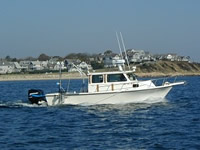
 Rafael |
Poppe, L.J.; Ackerman, S.D.; Foster, D.S.; Blackwood, D.S.; Williams, S.J.; Moser, M.S.; Stewart, H.F.; Glomb, K.A., 2007, Sea-floor character and sedimentary processes of Great Round Shoal Channel, offshore Massachusetts: U.S. Geological Survey Open-File Report 2007-1138, https://doi.org/10.3133/ofr20071138.
| Title | Survey Equipment | Description |
|---|---|---|
| Sample log | SeaBOSS | Sample log including station location, time, description, photo log. |
| Survey Equipment | Survey Info | Data Type(s) | Data Collected |
|---|---|---|---|
| SeaBOSS | --- | Surveys (biological) Experiments (biological) Species ID Photo Video Geology Biology | 2006-005-FA-VD-001 (2 Hi-8 video tapes of bottom sediments.) 2006-005-FA-PH-002 (Bottom photos of sediments: 124 photos from 32 locations) |
| Digital camera | --- | Photo | 2006-005-FA-PH-001 (50 deck photos by D. Blackwood) |