Other ID: none
Status: Completed
Organization(s): USGS, Woods Hole Coastal and Marine Science Center
Funding Program(s):
Principal Investigator(s): Uri Ten Brink
Affiliate Investigator(s): Mike West and John Power, Alaska Volcano Observatory
Information Specialist(s): PARTNER
Data Type(s): Seismics: Ocean Bottom Seismometer
Scientific Purpose/Goals: Recover ocean bottom seismometers that monitored the volcanic activity of Mt. Augustine.
Vehicle(s):
Start Port/Location: Homer, AK
End Port/Location: Homer, AK
Start Date: 2006-03-25
End Date: 2006-03-26
Equipment Used: Ocean Bottom Seismometer
Information to be Derived:
Summary of Activity and Data Gathered: All ocean bottom seismometers were recovered successfully. All OBSes recorded data throughout the entire period. Preliminary examination of the data indicates good data quality.
Staff: Uri Ten Brink
Affiliate Staff:
Victor Bender - WHOI
OBS technician; Marlene Messina - WHOI
note taker; Cyrus Read - USGS-Anchorage; Matt Gardine
U. Alaska-Fairbanks student; Dan Jones
U. Alaska-Fairbanks student
Notes: Data Curator: WHOI, AVO.
Project = Enhanced monitoring and rapid response plans, Enhanced monitoring and rapid response plans
Location:
around Mt. Augustine, Cook Inlet, Alaska, United States, North America, North Pacific;
| Boundaries | |||
|---|---|---|---|
| North: 59.5 | South: 59.16667 | West: -153.5833 | East: -153.25 |
Platform(s):
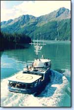 Maritime Maid |
| Survey Equipment | Survey Info | Data Type(s) | Data Collected |
|---|---|---|---|
| Ocean Bottom Seismometer | --- | Ocean Bottom Seismometer |
