Other ID: none
Status: Completed
Organization(s): USGS, Woods Hole Coastal and Marine Science Center
Funding Program(s):
Principal Investigator(s): David Twichell
Affiliate Investigator(s):
Information Specialist(s): Wayne Baldwin
Data Type(s): Location-Elevation: Navigation, Seismics: Sub Bottom Profiler, Sonar: Sidescan, Sonar: Interferometric
Scientific Purpose/Goals: The objectives of this cruise were to map the sea floor and shallow stratigraphy along the offshore side of the Chandeleur Islands off the eastern side of the Mississippi delta. This survey was done in collaboration with the USGS (St. Petersburg) and the Univ. of New Orleans who conducted geophysical surveys closer to shore than could be reached aboard the ACADIANA and along the back of the Chandeleur Islands. The reason for the mapping was to assess the effect of Hurricane Katrina on the sea floor surrounding these islands.
Vehicle(s):
Start Port/Location: Biloxi, MS
End Port/Location: Biloxi, MS
Start Date: 2006-07-06
End Date: 2006-07-18
Equipment Used: Edgetech chirp subbottom profiler 512i, DGPS, SEA SWATHplus-M 234 kHz, Klein 3000
Information to be Derived: Sea floor map; Bathymetric maps; Morphology;
Summary of Activity and Data Gathered: The Chandeleur Islands were severely damaged by Hurricanes Katrina and Rita, and the goal of this cruise was to map the inner shelf offshore of the northern part of the island chain to assess the impact of these hurricanes on the inner shelf. The survey covered an area approximately 5 km wide by 46 km long that started in water depths as shallow as 4.5 m and ended in water depths reaching 16 m. A series of shore parallel lines spaced approximately 150 m apart were complimented with a set of on/offshore lines spaced about 1 km apart. Sidescan sonar imagery, interferometric bathymetry and Chirp sub-bottom profiles were collected along all survey lines. The shore-parallel lines were spaced to provide continuous sidescan sonar coverage, and about 50% bathymetric coverage. All data were logged digitally and were archived to DVD-ROM prior to the end of the cruise. Geophysical and navigation data were collected along 1877 km of survey lines.
Staff: Wayne Baldwin, Emile Bergeron, David Twichell, Charles Worley
Affiliate Staff:
Notes: Original Center People field contained: Charles Worley - electronics technician; Emile Bergeron - electronics technician; Wayne Baldwin - scientist, data archivist; Dave Twichell - chief scientist.
Project = Chandeleur Island Mapping, Chandeleur Island Mapping
Location:
Chandeleur Islands, Chandeleur Sound, Louisiana, United States, Gulf of Mexico, North America, North Atlantic;
| Boundaries | |||
|---|---|---|---|
| North: 30.11252985 | South: 29.70435604 | West: -88.90945578 | East: -88.77579325 |
Platform(s):
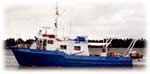 Acadiana |
Kindinger, J.L., Buster, N.A., Flocks, J.G., Bernier, J.C., Kulp, M.A., 2013, Louisiana Barrier Island Comprehensive Monitoring (BICM) Program summary report: Data and analyses 2006 through 2010: U.S. Geological Survey Open-File Report 2013-1083, 86 p., https://doi.org/10.3133/ofr20131083.
Mickey, R.C., Long, J.W., Plant, N.G., Thompson, D.M., Dalyander, P.S., 2017, A methodology for modeling barrier island storm-impact scenarios: U.S. Geological Survey Open-File Report 2017-1009, https://doi.org/10.3133/ofr20171009.
Baldwin, W.E., Pendleton, E.A., Twichell, D.C., 2009, Geophysical data from offshore of the Chandeleur Islands, Eastern Mississippi Delta: U.S. Geological Survey Open-File Report 2008-1195, https://doi.org/10.3133/ofr20081195.
Flocks, J., Miner, Michael D., Twichell, David C., Lavoie, Dawn L., and Kindinger, Jack, 2009, Evolution and preservation potential of fluvial and transgressive deposits on the Louisiana inner shelf; understanding depositional processes to support coastal management: Geo-Marine Letters, v. 29 no. 6, doi: 10.1007/s00367-009-0164-4.
Twichell, D., Pendleton, Elizabeth, Baldwin, Wayne, and Flocks, James, 2009, Subsurface control on seafloor erosional processes offshore of the Chandeleur Islands, Louisiana: Geo-Marine Letters, v. 29 no. 6, doi: 10.1007/s00367-009-0150-x.
FAN 2006-015-FA has data viewable in the GeoMappApp/Virtual Ocean applications. To view this data in these applications go to http://www.geomapapp.org/ and http://www.virtualocean.org/. See the instructions for locating USGS data in these applications. You can also view the imagery created from the SEGY data at https://cmgds.marine.usgs.gov/images.php?cruise=2006-015-FA.
| Survey Equipment | Survey Info | Data Type(s) | Data Collected |
|---|---|---|---|
| Edgetech chirp subbottom profiler 512i | --- | Sub Bottom Profiler | Chirp seismic data Chirp seismic images |
| DGPS | --- | Navigation | |
| SEA SWATHplus-M 234 kHz | --- | Interferometric | Bathymetry GIS data |
| Klein 3000 | --- | Sidescan | Sidescan mosaic |
