Other ID: none
Status: Completed
Organization(s): USGS, Woods Hole Coastal and Marine Science Center
Funding Program(s):
Principal Investigator(s): John Crusius
Affiliate Investigator(s):
Information Specialist(s): John Crusius
Data Type(s): Environmental Data: Conductivity, Environmental Data: Dissolved Oxygen, Environmental Data: ORP, Environmental Data: Radon, Environmental Data: Temperature, Environmental Data: pH, Imagery: Photo, Location-Elevation: Navigation
Scientific Purpose/Goals: Radon mapping and discrete water sampling in West Falmouth Harbor corroborated by infrared fly-over to detect low-temperature groundwater discharge organized with collaborator Ann Giblin, MBL.
Vehicle(s):
Start Port/Location: West Falmouth Harbor, MA
End Port/Location: West Falmouth Harbor, MA
Start Date: 2006-08-09
End Date: 2006-08-10
Equipment Used: RAD7 radon detection instrument, YSI multiparameter sonde, Digital camera, GPS (wh)
Information to be Derived:
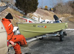
Summary of Activity and Data Gathered: Mapping of water-column radon activity throughout all of West Falmouth Harbor took place on two consecutive days on August 9 and 10, each time covering a large portion of the harbor during a low spring tide and with the same equipment setup as on July 7. No discrete radon samples were collected during this field effort, but 15 water-column samples were collected and filtered for later radium analyses using a bilge pump to pull water into containers carried aboard an MBL owned and operated boat. This event was coordinated with simultaneous thermal imaging conducted from a small aircraft (carried out during the afternoon of August 10 by scientists from the EPA Narragansett Bay lab).
Staff: Dann Blackwood, John Crusius, Laura Erban, Dirk Koopmans, Max Nepstad, Diomaris Padilla
Affiliate Staff:
Clara Funk (boat driver
MBL)
Laura Whitman (boat driver
MBL)
Notes: Related field activities: http://quashnet.er.usgs.gov/data/2006/06020/, http://quashnet.er.usgs.gov/data/2006/06021/, http://quashnet.er.usgs.gov/data/2006/06025/, http://quashnet.er.usgs.gov/data/2006/06037/. Original Center People field contained: Dirk Koopmans; Laura Erban; Max Nepstad; Diomaris Padilla; John Crusius; Dann Blackwood (TERRAPIN driver).
Project = Ground water coastal aquifers, Ground water coastal aquifers
Location:
West Falmouth Harbor, Snug Harbor, Falmouth, Buzzards Bay, Massachusetts, United States, North America, North Atlantic;
| Boundaries | |||
|---|---|---|---|
| North: 41.61 | South: 41.59 | West: -70.65 | East: -70.63 |
Platform(s):
 Terrapin | MWRA Whaler |
Bratton, J.F., 2007, The importance of shallow confining units to submarine groundwater flow, in Sanford, W., Langevin, C., Polemio, M., and Povinec, P., eds., A New Focus on Groundwater-Seawater Interactions: International Association of Hydrological Sciences, v. 312.
| Survey Equipment | Survey Info | Data Type(s) | Data Collected |
|---|---|---|---|
| RAD7 radon detection instrument | --- | Radon | |
| YSI multiparameter sonde | --- | Conductivity Dissolved Oxygen ORP pH Temperature | |
| Digital camera | --- | Photo | 2006-026-FA-PH-001 (Deck photos of field activity operations) |
| GPS (wh) | --- | Navigation |
