Other ID: none
Status: Completed
Organization(s): USGS, Woods Hole Coastal and Marine Science Center
Funding Program(s):
Principal Investigator(s): Michael Bothner
Affiliate Investigator(s): William Martin, WHOI
Information Specialist(s): Michael Casso
Data Type(s): Imagery: Photo, Imagery: Video, Sampling: Biology, Sampling: Geology
Scientific Purpose/Goals: Collect sediment cores at one station in Boston Harbor (Hingham Bay) for pore water analysis and for lab-based erosion studies.
Vehicle(s):
Start Port/Location: Hingham Harbor, MA
End Port/Location: Hingham Harbor, MA
Start Date: 2006-10-11
End Date: 2006-10-11
Equipment Used: Video camera - deep sea, Digital camera, Push corer (wh)
Information to be Derived: Samples and chemical analysis;
Summary of Activity and Data Gathered: The divers collected the required samples with excellent quality and in a short amount of time. We used a kayak to make a 3-point mooring which was very effective in holding the boat on location. This gave us perfect conditions to test the pole corer in these sediments with poor results as described below. RAFAEL was launched near Hingham on October 10 and tied up overnight at a floating dock next to the Ferry Boat dock. The pole core was tried twice without satisfactory results. For pole cores we restricted penetration to about 30 cm to fit the sediment core into the erosion chamber. This did not penetrate firm enough sediment to make a plug of mud at the bottom of the core (the surface had very high water content). The sample partially fell out of the bottom of the barrel before we could get the piston into the barrel just below the sea surface using Dann's long arm. The push corer worked ok in Falmouth Harbor sediments with a barrel pushed in to maximum sediment depth. Approximately 7 cores were collected by divers and processed in the laboratory for pore water profiles, erosion experiments and resistivity.
Staff: Sandy Baldwin, Dann Blackwood, Michael Bothner, Richard Rendigs
Affiliate Staff:
W. Martin - WHOI (geochemist)
Notes: Original Center People field contained: D. Blackwood (boat captain and diving consultant); R. Rendigs and S. Baldwin (divers); Mike Bothner (chief scientist).
Project = Coastal Geologic Processes and Long-Term Environmental Change, Coastal Geologic Processes and Long-Term Environmental Change
Location:
Hingham Bay, Boston Harbor, Massachusetts, United States, North America, North Atlantic;
| Boundaries | |||
|---|---|---|---|
| North: 42.3 | South: 42.28333 | West: -70.9333 | East: -70.91667 |
Platform(s):
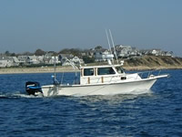
 Rafael |
Bothner, M.H., and Butman, Bradford (eds.), 2007, Processes influencing the transport and fate of contaminated sediments in the coastal ocean—Boston Harbor and Massachusetts Bay: U.S. Geological Survey Circular 1302, 89 p., https://doi.org/10.3133/cir1302.
| Survey Equipment | Survey Info | Data Type(s) | Data Collected |
|---|---|---|---|
| Video camera - deep sea | --- | Video | |
| Digital camera | --- | Photo | 2006-028-FA-PH-001 (Deck photos of field activity operations) |
| Push corer (wh) | --- | Biology Geology |