Other ID: none
Status: Completed
Organization(s): USGS, Woods Hole Coastal and Marine Science Center
Funding Program(s):
Principal Investigator(s): Christopher Sherwood
Affiliate Investigator(s): WHOI, ONR
Information Specialist(s): Ellyn Montgomery
Data Type(s): Environmental Data: CTD, Environmental Data: Conductivity, Environmental Data: Temperature, Imagery: Photo, Location-Elevation: Navigation, Sampling: Geology, Sonar: Single Beam, Time Series: Mooring (physical oceanography), Visual Identification: Ground Truthing
Scientific Purpose/Goals: Recover 2 tripods, mooring #836 (particle/sonar) and 837.
Vehicle(s):
Start Port/Location: Woods Hole, MA
End Port/Location: Woods Hole, MA
Start Date: 2007-10-29
End Date: 2007-10-29
Equipment Used: Mooring tripod, Temperature and salinity, Pressure, Turbidity, Current, Rotating Imagenex sonar, Two-axis pencil-beam Imagenex sonar, Acoustic backscatter sensors, Digital camera, GPS (wh), Grab sampler, Bottom platform
Information to be Derived: Time series data; Suspended sediment concentrations; Morphology;
Summary of Activity and Data Gathered: Recovered USGS tripods: 2 (mooring #836 and 837; deployed CONN FA 07028, Aug. 27, 2008). Recovered WHOI tripods.
Staff: Jonathan Borden, Benedicte Ferre, Marinna Martini, Ellyn Montgomery, Christopher Sherwood
Affiliate Staff:
Chris Hein
Boston University student; Peter Traykovski
WHOI; Fred Thwaites
WHOI; Andy Girard
WHOI
Notes: Project = ONR Ripples DRI, ONR Ripples DRI
Location:
Martha's Vineyard Coastal Observatory, Massachusetts, United States, North America, North Atlantic;
| Boundaries | |||
|---|---|---|---|
| North: 41.35 | South: 41.26667 | West: -70.6167 | East: -70.48333 |
Platform(s):
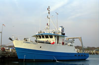
 Connecticut |
Denny, J.F., Danforth, W.W., Foster, D.S., and Sherwood, C.R., 2009, Geophysical data collected off the south shore of Martha's Vineyard, Massachusetts: U.S. Geological Survey Open-File Report 2008-1288, also available at https://doi.org/10.3133/ofr20081288.
Montgomery, E., Sherwood, C, 2013, Studying seafloor bedforms using autonomous stationary imaging and profiling sonars: OCEANS'13 MTS/IEEE Proceedings Paper, pp. 1–7, URL: http://ieeexplore.ieee.org/xpl/freeabs_all.jsp?arnumber=6741159&abstractAccess=no&userType=inst.
| Survey Equipment | Survey Info | Data Type(s) | Data Collected |
|---|---|---|---|
| Mooring tripod | --- | Ground Truthing | |
| Temperature and salinity | --- | CTD Temperature | |
| Pressure | --- | Mooring (physical oceanography) | |
| Turbidity | --- | Mooring (physical oceanography) | |
| Current | --- | Mooring (physical oceanography) | |
| Rotating Imagenex sonar | --- | Single Beam | |
| Two-axis pencil-beam Imagenex sonar | --- | Single Beam | |
| Acoustic backscatter sensors | --- | Single Beam | |
| Digital camera | --- | Photo | |
| GPS (wh) | --- | Navigation | |
| Grab sampler | --- | Biology Geology | |
| Bottom platform | --- | Mooring (physical oceanography) |