Other ID: none
Status: Completed
Organization(s): USGS, Woods Hole Coastal and Marine Science Center
Funding Program(s):
Principal Investigator(s): Richard Signell
Affiliate Investigator(s):
Information Specialist(s): Richard Signell
Data Type(s): Environmental Data: Current, Location-Elevation: Navigation, Time Series: Mooring (physical oceanography)
Scientific Purpose/Goals: Shipboard ADCP survey of ebb tidal currents over Middle Ground. We will attempt to document both the cross-bank structure of the tidal currents over 800 m long across-bank transects. We will also attempt to measure the detailed vertical current structure between two large sand waves (amplitude 2-4 m) over two wavelengths (~150 m).
Vehicle(s):
Start Port/Location: Falmouth Harbor, MA
End Port/Location: Falmouth Harbor, MA
Start Date: 2007-08-10
End Date: 2007-08-10
Equipment Used: Current, ADCP, GPS (wh)
Information to be Derived:
Summary of Activity and Data Gathered: We collected shipboard ADCP tidal currents over the ebb tidal cycle (flowing toward SW) on Middle Ground. We observed strong lateral shear in the tidal currents caused by Middle Ground and headlands along Martha's Vineyard. We used Teladyne/RDI WinRiver II software to collect the data, and this software produced two types of files for each of the 6 transects we conducted: (1) a binary file *.PD0 that contains raw information in beam/ship coordinates; (2) an ASCII file *_GPS.TXT which contains the DGPS navigation data. Barry Irwin also provided a RTK GPS navigation file at 1 s intervals after the cruise. RTK GPS data was not included in the data stream to the RDI WinRiver II software. Next time this should be included.
Staff: Jonathan Borden, Barry Irwin, Richard Signell
Affiliate Staff:
Timothy Driskell (WRD-Northboro
MA)
ADCP Expert
Notes: Original Center People field contained: Rich Signell, Chief Scientist; Barry Irwin, Boat Operator; Jonathan Borden, Chief Technician.
Project = Middle Ground Study, Middle Ground Study
Location:
Middle Ground, Vineyard Sound, Massachusetts, United States, North America, North Atlantic;
| Boundaries | |||
|---|---|---|---|
| North: 41.5 | South: 41.43333 | West: -70.6833 | East: -70.61667 |
Platform(s):
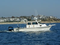
 Rafael |
| Survey Equipment | Survey Info | Data Type(s) | Data Collected |
|---|---|---|---|
| Current | --- | Mooring (physical oceanography) | |
| ADCP | --- | Current | 2007-031-FA-GP-001 (Accoustic Doppler Current Profiler (ADCP) data: data files in various formats with plots.) |
| GPS (wh) | --- | Navigation | 2007-031-FA-LN-001 (Navigation data: x, y, z coordinates for 08/10/07 taken every second; stored in an Excel spreadsheet.) |