Other ID: none
Status: Completed
Organization(s): USGS, Woods Hole Coastal and Marine Science Center
Funding Program(s):
Principal Investigator(s): Uri Ten Brink
Affiliate Investigator(s): David DuBois - WHOI
Information Specialist(s):
Data Type(s): Seismics: Ocean Bottom Seismometer, Location-Elevation: Navigation
Scientific Purpose/Goals: Recover 5 short-period OBSes deployed in the Puerto Rico Trench on March 8, 2007 from the NOAA vessel NANCY FOSTER by USGS and WHOI scientists.
Vehicle(s):
Start Port/Location: Mayaguez, Puerto Rico
End Port/Location: San Juan, Puerto Rico
Start Date: 2007-08-31
End Date: 2007-09-05
Equipment Used: Ocean Bottom Seismometer, GPS (wh)
Information to be Derived: Morphology;
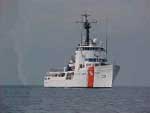
Summary of Activity and Data Gathered: Three swarms with at least 518 earthquakes while the OBSes were recording. While on the way to pick up the OBSes, the DAUNTLESS was diverted to pick up 31 Dominican migrants drifting on a small boat in the high seas (see URL https://www.piersystem.com/go/doc/586/170631/). OBSes recovered: 5 (deployed NANCY FOSTER FA 07004 March 8, 2007).
Staff: Alberto Lopez, Uri Ten Brink
Affiliate Staff:
WHOI: David Dubois
Alan Gardner
Notes: Original Center People field contained: Uri ten Brink - chief scientist; Alberto Lopez.
Project = Tsunami and earthquake hazard for the NE Caribbean, Tsunami and earthquake hazard for the NE Caribbean
Location:
Puerto Rico Trench, off northeast Puerto Rico, north of the Virgin Islands, northeast Caribbean, North Atlantic;
| Boundaries | |||
|---|---|---|---|
| North: 20 | South: 19.2 | West: -65.35 | East: -63.25 |
Platform(s):
 Dauntless |
| Survey Equipment | Survey Info | Data Type(s) | Data Collected |
|---|---|---|---|
| Ocean Bottom Seismometer | --- | Ocean Bottom Seismometer | |
| GPS (wh) | --- | Navigation |
