Other ID: NMFS HB0806; B-1-08-GK
Status: Completed
Organization(s): USGS, Woods Hole Coastal and Marine Science Center
Funding Program(s):
Principal Investigator(s): Page Valentine
Affiliate Investigator(s): Vince Guida, NMFS, Sandy Hook, NJ; Jeremy Collie, URI
Information Specialist(s): Page Valentine
Data Type(s): Environmental Data: CTD, Imagery: Photo, Imagery: Video, Location-Elevation: Navigation, Sampling: Biology, Sampling: Geology
Scientific Purpose/Goals: Georges Bank habitat studies and seabed mapping.
Vehicle(s):
Start Port/Location: Newport Naval Base, RI
End Port/Location: Newport Naval Base, RI
Start Date: 2008-08-13
End Date: 2008-08-26
Equipment Used: Trawl, Dredge, CTD 19+ with OBS, PAR, DO, Chl, SeaBOSS, Digital camera, GPS (wh)
Information to be Derived: Reports; maps
Summary of Activity and Data Gathered: SEABOSS video/photo stations: 138; bottom temp stations: 138; sediment samples: 4; invasive tunicate Didemnum vexillum samples: 1. Additional otter trawl and bottom dredge samples taken for biological analysis collected and curated by Jeremy Collie, University of Rhode island.
Staff: Philip Bernard, Dann Blackwood, Barry Irwin, Page Valentine
Affiliate Staff:
NOAA: Vince Guida; URI: Jeremy Collie
Nicole Lengyel
Notes: Mobe will begin on Monday, Aug. 11 at the Navy base in Newport, Rhode Island. Ship returns to Newport on Tuesday morning, Aug. 26. Original Center People field contained: At sea: Page Valentine, Dann Blackwood; Mobe/demobe: PJ Bernard, Barry Irwin.
Project = Benthic Habitats: Geological and Biological Studies, Benthic Habitats: Geological and Biological Studies
Location:
Georges Bank, United States, North America, North Atlantic,
| Boundaries | |||
|---|---|---|---|
| North: 42.2 | South: 41.65 | West: -67.85 | East: -66.3 |
Platform(s):
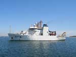 Henry B Bigelow |
| Survey Equipment | Survey Info | Data Type(s) | Data Collected |
|---|---|---|---|
| Trawl | --- | Biology | 2008-006-FA-SC-003 (Additional otter trawl and bottom dredge samples for biological analysis.) |
| Dredge | --- | Biology Geology | 2008-006-FA-SC-002 (Invasive tunicate Didemnum vexillum samples: 1.) 2008-006-FA-SC-002-01 (D. vexillum sample identification) |
| CTD 19+ with OBS, PAR, DO, Chl | --- | CTD | |
| SeaBOSS | --- | Surveys (biological) Experiments (biological) Species ID Photo Video Geology Biology | 2008-006-FA-NL-001 (Logs for CAMERA, ) |
| Digital camera | --- | Photo | 2008-006-FA-PH-002 (Deck photos: 292 deck photos of crew, equipment, processes, biological trawl catch, scenery, etc. by D. Blackwood.) |
| GPS (wh) | --- | Navigation |
