Other ID: OC 444; O-21-08-NA
Status: Completed
Organization(s): USGS, Woods Hole Coastal and Marine Science Center
Funding Program(s):
Principal Investigator(s): Uri Ten Brink
Affiliate Investigator(s): WHOI
Information Specialist(s): Jason Chaytor, PARTNER
Data Type(s): Imagery: Photo, Imagery: Video, Location-Elevation: Navigation, Sonar: Single Beam, Seismics: Sub Bottom Profiler
Scientific Purpose/Goals: Map submarine landslides as part of a WHOI test cruise of the hybrid AUV/ROV SENTRY.
Vehicle(s):
Start Port/Location: Woods Hole, MA
End Port/Location: Woods Hole, MA
Start Date: 2008-04-18
End Date: 2008-04-24
Equipment Used: ROV, GPS (wh), Knudsen echo sounder 320B/R
Information to be Derived:
Summary of Activity and Data Gathered: Using the hull-mounted Knudsen 320B/R deepwater echo sounder on the OCEANUS, approximately 1065 km of 3.5 kHz sub-bottom data were collected over the 6 days of the cruise (see map). Data were acquired in both Knudsen proprietary binary format (.keb) viewable only in the Knudsen 'Post Survey' software and in standard SEG-Y format for later processing. Multibeam data was not collected in the survey area because of technical problems with the RESON multibeam sonar aboard the Sentry.
Staff: Jason Chaytor, Uri Ten Brink
Affiliate Staff:
1. Dr. Christopher German
Chief Scientist
Woods Hole Oceanographic Institution; 2. Dr. Dana Yoerger
Woods Hole Oceanographic Institution; 3. Mr. Rodney Catanach
Woods Hole Oceanographic Institution; 5. Mr. Alan Duester
Woods Hole Oceanographic Institution; 6. Dr. James Kinsey
Woods Hole Oceanographic Institution; 7. Dr. Robert Detrick
Woods Hole Oceanographic Institution; 8. Dr. Henrietta Edmonds
University of Texas Marine Science Institute
Port Aransas
TX; 9. Mr. Alexander Dorsk
Woods Hole Oceanographic Institution
Notes: This is part of a WHOI engineering testing cruise. The full cruise report is being prepared by Drs. Chris German and Dana Yoerger. Data Curator: WHOI.
Information from Foghorn: AUV/ROV Sentry;Knudsen echo sounder 320B/R.
Also: WHOI will be data curator for complete cruise; U. ten Brink will be WHSC contact; J. Chaytor will be data curator for data to be processed by WHSC. No WHSC project number; funded by WHOI.
Location:
New England continental slope, United States, North America, North Atlantic;
| Boundaries | |||
|---|---|---|---|
| North: 40 | South: 39 | West: -71.5 | East: -70.75 |
Platform(s):
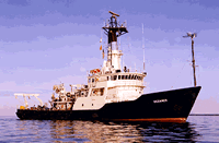
 Oceanus |
| Survey Equipment | Survey Info | Data Type(s) | Data Collected |
|---|---|---|---|
| ROV | --- | Photo Video Biology Geology | |
| GPS (wh) | --- | Navigation | |
| Knudsen echo sounder 320B/R | --- | Sub Bottom Profiler |