Other ID: HE0905, H609AR
Status: Completed
Organization(s): USGS, Woods Hole Coastal and Marine Science Center
Funding Program(s): Other (Other)
Principal Investigator(s): Deborah Hutchinson
Affiliate Investigator(s): Larry Mayer, University of New Hampshire
Information Specialist(s): Deborah Hutchinson
Data Type(s): Environmental Data: CTD, Imagery: Photo, Location-Elevation: Navigation, Seismics: Sub Bottom Profiler, Sonar: Multibeam, Sonar: Single Beam
Scientific Purpose/Goals: Multibeam and Chirp mapping of the sea floor of potential U.S. extended continental shelf in the Arctic Ocean north of Alaska.
Vehicle(s):
Start Port/Location: Barrow, AK
End Port/Location: Barrow, AK
Start Date: 2009-08-07
End Date: 2009-09-16
Equipment Used: Knudsen echo sounder 320B/R, CTD 19+ with OBS, PAR, DO, Chl, Digital camera, GPS (wh), SeaBeam 2112, Other, Echosounder
Information to be Derived: Sea floor map; Bathymetric maps; Morphology; Shallow sediment structure from Knudsen single-channel seismics
Summary of Activity and Data Gathered: USCGC HEALY provided ice breaking during collection of multichannel seismic data by the GSC aboard CCGS LOUIS S. ST-LAURENT.
Staff: Thomas O'Brien
Affiliate Staff:
Notes: Cruise is currently devoted 100% to two-icebreaker work. Data Curator: UNH.
Location:
Arctic Ocean;
| Boundaries | |||
|---|---|---|---|
| North: 85 | South: 70 | West: -160 | East: -125 |
Platform(s):
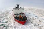 Healy |
Hutchinson, D.R., and Barth, G.A., 2010, Continental margins and the U.S. Extended Continental Shelf Project: MARGINS/GeoPRISMS Newsletter, no. 25, URL: http://www.nsf-margins.org/Publications/Newsletters/Issue25.pdf.
| Survey Equipment | Survey Info | Data Type(s) | Data Collected |
|---|---|---|---|
| Knudsen echo sounder 320B/R | --- | Sub Bottom Profiler | |
| CTD 19+ with OBS, PAR, DO, Chl | --- | CTD | |
| Digital camera | --- | Photo | |
| GPS (wh) | --- | Navigation | |
| SeaBeam 2112 | --- | Multibeam | |
| Other | --- | --- | --- |
| Echosounder | --- | Single Beam |
