Other ID: none
Status: Completed
Organization(s): USGS, Woods Hole Coastal and Marine Science Center
Funding Program(s):
Principal Investigator(s): Carolyn Ruppel
Affiliate Investigator(s): Harry Hemond - MIT
Information Specialist(s): Carolyn Ruppel
Data Type(s): Location-Elevation: Navigation, Seismics: Sub Bottom Profiler
Scientific Purpose/Goals: Test new seismic fish and topside unit configuration in a lake setting known to be characterized by methane emissions.
Vehicle(s):
Start Port/Location:
End Port/Location:
Start Date: 2009-06-08
End Date: 2009-06-08
Equipment Used: DGPS, EdgeTech 424 chirp sub-bottom profiler
Information to be Derived:
Summary of Activity and Data Gathered: Collected Chirp data over most of lake; Lowrance GPS failed a few times.
Staff: Carolyn Ruppel, Charles Worley
Affiliate Staff:
Charuleka Varadharajan
MIT
Notes:
Project = High-Latitude Climate-Hydrates Interactions - Dept. of Energy, High-Latitude Climate-Hydrates Interactions - Dept. of Energy
Location:
Upper Mystic Lake, Medford, Massachusetts, United States, North America;
| Boundaries | |||
|---|---|---|---|
| North: 42.4465 | South: 42.4218 | West: -71.1556 | East: -71.1412 |
Platform(s):
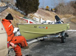 Terrapin |
| Survey Equipment | Survey Info | Data Type(s) | Data Collected |
|---|---|---|---|
| DGPS | --- | Navigation | |
| EdgeTech 424 chirp sub-bottom profiler | --- | Sub Bottom Profiler |
