Other ID: H-3-10-AR (Menlo Park)
Status: Completed
Organization(s): USGS, Woods Hole Coastal and Marine Science Center
Funding Program(s):
Principal Investigator(s): Deborah Hutchinson, William Danforth
Affiliate Investigator(s): Brian Edwards, USGS-Menlo Park, CA
Information Specialist(s): William Danforth
Data Type(s): Location-Elevation: Navigation, Seismics: Sub Bottom Profiler, Sonar: Multibeam
Scientific Purpose/Goals: Two-icebreaker US-Canada experiment to identify the outer limits of the extended continental shelf of each nation in the western Arctic Ocean.
Vehicle(s):
Start Port/Location: Dutch Harbor, AK
End Port/Location: Barrow, AK
Start Date: 2010-08-03
End Date: 2010-09-05
Equipment Used: GPS (wh), Knudsen echo sounder 320B/R, Simrad EM120
Information to be Derived: Bathymetric maps; Sea floor map; Sediment thickness maps;
Summary of Activity and Data Gathered: Collected 12 kHz Bathymetry (Simrad EM122) to identify the 2500-meter contour on widely spaced tracklines. Multichannel seismic profiles were collected aboard the LOUIS S. ST. LAURENT to map sediment thicknesses.
Staff: Thomas O'Brien
Affiliate Staff:
Notes: No WHSC staff were aboard the Canadian ice breaker LOUIS S. ST. LAURENT (J. Childs, USGS-Menlo Park, CA will be liaison aboard LOUIS).
Project = Law of the Sea - New Data Acquisition, Law of the Sea - New Data Acquisition
Location:
Western Arctic Ocean;
| Boundaries | |||
|---|---|---|---|
| North: 84.05256 | South: 71.96539 | West: -166.289 | East: -129.375 |
Platform(s):
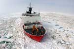 Healy |
Childs, J.R., Triezenberg, P.J., and Danforth, W.W., 2012, 2008 Joint United States-Canadian program to explore the limits of the Extended Continental Shelf aboard the U.S. Coast Guard cutter HealyâCruise HLY0806: U.S. Geological Survey Open-File Report 2012-1210, 15 p., http://pubs.usgs.gov/of/2012/1210/.
Edwards, B.D., Childs, J.R., Triezenberg, P.J., Danforth, W.W., and Gibbons, Helen, 2013, 2010 Joint United States-Canadian Program to explore the limits of the Extended Continental Shelf aboard U.S. Coast Guard Cutter HealyâCruise HLY1002: U.S. Geological Survey Open-File Report 2013-1067, http://pubs.usgs.gov/of/2013/1067/.
Hutchinson, D., Houseknecht, D., Mosher, D., Hart, P., Jackson, R., Lebedeva-Ivanova, N., Shimeld, J., and Chian, D., The Chukchi Borderland: a sediment-starved rifted continental margin [abs.]: , 2013 Fall AGU Meeting. San Francisco,CA, December 9-13, 2013.
Hutchinson, D.R., and Barth, G.A., 2010, Continental margins and the U.S. Extended Continental Shelf Project: MARGINS/GeoPRISMS Newsletter, no. 25, URL: http://www.nsf-margins.org/Publications/Newsletters/Issue25.pdf.
Lebedeva-Ivanova, N., Hutchinson, D.R., Shimeld, J., Brumley, K., Chian, D., Hart, P., Mosher, D., and Jackson, R., Inferred Mesozoic Origin of the Nautilus Basin, Arctic Ocean [abs.]: , 3P Arctic â The Polar Petroleum Potential Conference and Exhibition. Stavanger, Norway, 15-18 October, 2013.
| Survey Equipment | Survey Info | Data Type(s) | Data Collected |
|---|---|---|---|
| GPS (wh) | --- | Navigation | |
| Knudsen echo sounder 320B/R | --- | Sub Bottom Profiler | |
| Simrad EM120 | --- | Multibeam |
