Other ID: none
Status: Completed
Organization(s): USGS, Woods Hole Coastal and Marine Science Center
Funding Program(s): Hurricane Sandy - Linking Coastal Processes and Vulnerability – Fire Island Regional Study (AE03FJ6)
Principal Investigator(s): William Schwab
Affiliate Investigator(s):
Information Specialist(s): Wayne Baldwin
Data Type(s): Location-Elevation: Navigation, Sonar: Interferometric, Sonar: Sound Velocity, Seismics: Sub Bottom Profiler
Scientific Purpose/Goals: Map nearshore/shoreface off Fire Island National Seashore.
Vehicle(s):
Start Port/Location: Woods Hole, MA
End Port/Location: Woods Hole, MA
Start Date: 2011-05-18
End Date: 2011-06-09
Equipment Used: HYPACK, Edgetech chirp subbottom profiler 512i, SEA SWATHplus-M 234 kHz, Sensor - MVP30 (Odim)
Information to be Derived: Sea floor map;Bathymetric maps;
Summary of Activity and Data Gathered: Area of inner shelf/lower shorface offshore of Fire Island, NY mapped using 234 kHz inteferometric sonar and 5 Hz-12 kHz chirp subbottom profiler (water depths >~8m)
Staff: Wayne Baldwin, Emile Bergeron, Eric Moore, Charles Worley
Affiliate Staff:
Paul Gayes (Coastal Carolina University)
Brian Johnson (Coastal Carolina University)
Notes: Barry Irwin, Cheryl Hapke, and Erika Lentz will provide shore support for navigation.
Project = Long Island Barrier Island,
Location:
Fire Island, New York, United States, North America, North Atlantic;
| Boundaries | |||
|---|---|---|---|
| North: 40.75143 | South: 40.5434 | West: -73.28112 | East: -72.73797 |
Platform(s):
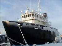 Scarlett Isabella |
Denny, J.F., Schwab, W.C., Baldwin, W.E., Moore, E., and Bergeron, E., 2015, High-resolution geophysical data collected offshore of Fire Island, New York in 2011, U.S. Geological Survey Field Activity 2011-005-FA: U.S. Geological Survey data release, https://doi.org/10.5066/F75X2704.
Goff, J.A., Flood, R.D., Austin, J.A., Schwab, W.C., Christensen, B., Browne, C.M., Denny, J.F., and Baldwin, W.E., 2015, The impact of Hurricane Sandy on the shoreface and inner shelf of Fire Island, New York—Large bedform migration but limited erosion: Continental Shelf Research, v. 98, p.13-25, https://doi.org/10.1016/j.csr.2015.03.001.
Schwab, W.C., Baldwin, W.E., Denny, J.F., Hapke, C.J., Gayes, P.T., List, J.H., and Warner, J.C., 2014, Modification of the Quaternary stratigraphic framework of the inner-continental shelf by Holocene marine transgression—An example offshore of Fire Island, New York: Marine Geology, vol. 355, p. 346-360, https://doi.org/10.1016/j.margeo.2014.06.011.
Schwab, W.C., Baldwin, W.E., Hapke, C.J., Lentz, E.E., Gayes, P.T., Denny, J.F., List, J.H., and Warner, J.C., 2013, Geologic evidence for onshore sediment transport from the inner continental shelf: Fire Island, New York: Journal of Coastal Research, vol. 29, issue 3, https://doi.org/10.2112/JCOASTRES-D-12-00160.1.
Schwab, W.C., Baldwin, W.E., Warner, J.C., List, J.H., Denny, J.F., Liste, M., and Safak, I., 2017, Change in morphology and modern sediment thickness on the inner-continental shelf offshore of Fire Island, New York between 2011 and 2014—Assessing the effect of hurricane impact: Marine Geology, v. 391, p. 48-64, https://doi.org/10.1016/j.margeo.2017.07.010.
Schwab, W.C., Baldwin, W.E., and Denny, J.F., 2016, Assessing the impact of Hurricanes Irene and Sandy on the morphology and modern sediment thickness on the inner continental shelf offshore of Fire Island, New York: U.S. Geologic Survey Open-File Report 2015-1238, https://doi.org/10.3133/ofr20151238.
Schwab, W.C., Baldwin, W.E., and Denny, J.F., 2014, Maps showing the change in modern sediment thickness on the Inner Continental Shelf Offshore of Fire Island, New York, between 1996–97 and 2011: U.S. Geological Survey Open-File Report 2014–1238, https://doi.org/10.3133/ofr20141238.
Schwab, W.C., Denny, J.F., and Baldwin, W.E., 2014, Maps showing bathymetry and modern sediment thickness on the inner continental shelf offshore of Fire Island, New York, pre-Hurricane Sandy: U.S. Geological Survey Open-File Report 2014–1203, https://doi.org/10.3133/ofr20141203.
Warner, J.C., Schwab, W.C., List, J.H., Safak, I., Liste, M., and Baldwin, W., 2017, Inner-shelf ocean dynamics and seafloor morphologic changes during Hurricane Sandy: Continental Shelf Research, v. 138, pp. 1–18, https://doi.org/10.1016/j.csr.2017.02.003.
| Survey Equipment | Survey Info | Data Type(s) | Data Collected |
|---|---|---|---|
| HYPACK | These are the navigation data acquired during survey operations and stored in HYPACK raw format. | Navigation | 2011-005-FA_HYPACK (Text files of the RTK-GPS, DGPS and Wide Area Augmentation System (WAAS) navigation collected by the USGS offshore of Fire Island, NY in 2011 (WGS 84, HYPACK ASCII text file formats).) |
| Edgetech chirp subbottom profiler 512i | This system is used to acquire chirp sub-bottom data in a frequency range of 500 Hz to 12 kHz. | Sub Bottom Profiler | 2011-005-FA_chimages (Images of Edgetech SB-512i chirp subbottom profiler data collected by the USGS offshore of Fire Island, NY in 2011 (PNG image format).) fi_cpun (100-meter grid representing the coastal plain unconformity (in meters) beneath the inner-continental shelf offshore of Fire Island, NY (FI_CPUN, UTM Zone 18N, WGS 84, Esri Binary Grid)) fi_hiso (50-meter grid representing the Holocene sediment thickness (in meters) on the inner-continental shelf offshore of Fire Island, NY (FI_HISO, UTM Zone 18N, WGS 84, Esri Binary Grid)) fi_hts (50-meter grid representing the Holocene transgressive surface (in meters) beneath the inner-continental shelf offshore of Fire Island, NY (FI_HTS, UTM Zone 18N, WGS 84, Esri Binary Grid)) 2011-005-FA_chirptrk (Trackline navigation for the Edgetech SB-512i chirp subbottom profiler data collected by the USGS offshore of Fire Island, NY in 2011 (Geographic, WGS 84, Esri polyline shapefile).) 2011-005-FA_chirp500sht (Shot point navigation at 500-shot intervals for the Edgetech SB-512i chirp subbottom profiler data collected by the USGS offshore of Fire Island, NY in 2011 (Geographic, WGS 84, Esri point shapefile, and unique shot point navigation included in CSV file format).) |
| SEA SWATHplus-M 234 kHz | This system is used to acquire swath bathymetric and acoustic backscatter data. | Interferometric | 2011-005-FA_swathtrk (Backscatter and bathymetric trackline navigation for the Bathyswath SWATHplus sonar collected by the USGS offshore of Fire Island, NY in 2011 (Geographic, WGS84, Esri polyline shape file).) fi_bathygrd (10-meter swath bathymetric grid collected by the U.S. Geological Survey offshore of Fire Island, NY in 2011 (UTM Zone 18N, WGS 84, Esri Binary Grid, FI_BATHYGRD)) FI_sonar5m (5-meter bacscatter mosaic of Bathyswath SWATHplus sonar image collected by the USGS offshore of Fire Island, NY in 2011 (UTM zone 18N, WGS 84, 24-bit continuous unsigned integer GeoTIFF format).) FI_Bathy5m (5-meter swath bathymetric grid collected by the USGS offshore of Fire Island, NY in 2011 (UTM zone 18N, WGS 84, Esri binary grid file format).) |
| Sensor - MVP30 (Odim) | This system is used to acquire the speed of sound within the water column during survey operations. | Sound Velocity | 2011-005-FA_mvp (Locations and data of sound velocity profiles collected by the USGS offshore of Fire Island, NY in 2011 (Geographic, WGS 84, Esri point shapefile, ASCII and PNG image formats).) |
