Other ID: none
Status: Completed
Organization(s): USGS, Woods Hole Coastal and Marine Science Center
Funding Program(s):
Principal Investigator(s): William Schwab
Affiliate Investigator(s):
Information Specialist(s): William Danforth
Data Type(s): Sonar: Interferometric, Location-Elevation: Navigation, Sonar: Sound Velocity, Seismics: Sub Bottom Profiler
Scientific Purpose/Goals: Map archeologic sites with BOEM - designed to test various geophysical gear
Vehicle(s):
Start Port/Location: Woods Hole
End Port/Location: Woods Hole
Start Date: 2012-08-24
End Date: 2012-09-09
Equipment Used: SEA SWATHplus-M 234 kHz, DGPS, Sensor - MVP30 (Odim), Sensor - SVP, Edgetech chirp subbottom profiler 512i
Information to be Derived: Sea floor map;Bathymetric maps;
Summary of Activity and Data Gathered: Interagency cooperative assessing utility of inteferomentric sonar in archeologic investigations. Will also compare to sidescan sonar and chirp subbottom data.
Staff: Wayne Baldwin, Emile Bergeron, William Danforth, Thomas O'Brien
Affiliate Staff:
Notes:
Project = BOEM/Vineyard Shelf Windfarm Mapping,
Location:
Martha's Vineyard Inner-continental shelf, Massachusetts, North America, North Atlantic
| Boundaries | |||
|---|---|---|---|
| North: 41.22412 | South: 41.05864 | West: -70.7629 | East: -70.46631 |
Platform(s):
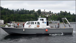 SRVx |
| Survey Equipment | Survey Info | Data Type(s) | Data Collected |
|---|---|---|---|
| SEA SWATHplus-M 234 kHz | --- | Interferometric | |
| DGPS | --- | Navigation | |
| Sensor - MVP30 (Odim) | --- | Sound Velocity | |
| Sensor - SVP | --- | Sound Velocity | |
| Edgetech chirp subbottom profiler 512i | --- | Sub Bottom Profiler |
