Other ID: none
Status: Completed
Organization(s): USGS, Woods Hole Coastal and Marine Science Center
Funding Program(s):
Principal Investigator(s): Daniel Brothers
Affiliate Investigator(s):
Information Specialist(s): Claudia Flores
Data Type(s): Seismics: Multichannel, Seismics: Sparker, Location-Elevation: Navigation
Scientific Purpose/Goals: Siesmic profiling across the Currituck submarine slide. Follow-up cruise from July cruise that was cut short due to equipment failure.
Vehicle(s):
Start Port/Location: Ocean City, MD
End Port/Location: Ocean City, MD
Start Date: 2012-10-09
End Date: 2012-10-16
Equipment Used: Multichannel seismics, Sparker , DGPS
Information to be Derived: Morphology;
Summary of Activity and Data Gathered: 72-ch high resolution sparker MCS collected aboard the M/V Tiki along the Currituck submarine landslide. Over 800 line-km were collected. Depth control birds on the seismic streamer failed and we had to use lead weights. Some statics corrections will be necessary during processing.
Staff: Brandy Armstrong, Emile Bergeron, Laura Brothers, Jason Chaytor, William Danforth, Thomas O'Brien, Jeffrey Obelcz, Uri Ten Brink
Affiliate Staff:
Notes: 72-ch sparker MCS system.
NOTE: the coring cruise will have the flatbed truck until Sat Oct. 6th. We will have to load the truck sometime that weekend in order to leave first thing Tuesday Oct. 9. Plan is to MOB Oct 10, depart afternoon on the 10th, survey until the 15th and return to port. Demob and return home will is slated for the 16th.
Project = NRC/Tsunami Landslide,
Location:
Cape Hatteras, North Carolina, United States, North America, North Atlantic;, outer shelf and slope NW of Cape Hatteras
| Boundaries | |||
|---|---|---|---|
| North: 37.59682 | South: 35.26356 | West: -73.3887 | East: -70.53223 |
Platform(s):
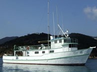 Tiki XIV |
| Survey Equipment | Survey Info | Data Type(s) | Data Collected |
|---|---|---|---|
| Multichannel seismics | --- | Multichannel | |
| Sparker | --- | Sparker | |
| DGPS | --- | Navigation |
