Other ID: none
Status: Completed
Organization(s): USGS, Woods Hole Coastal and Marine Science Center
Funding Program(s): USGS GAS HYDRATES (LQ000FP)
Principal Investigator(s): Carolyn Ruppel
Affiliate Investigator(s): Ruppel not going on cruise; Pat Hart (PCMSC) and Seth Haines (Denver) co-chiefs
Information Specialist(s): PARTNER
Data Type(s): Seismics: Multichannel, Seismics: Sparker
Scientific Purpose/Goals: High resolution seismics and 4C OBS work at deepwater Gulf of Mexico sites previously drilled/logged through DOE/Chevron JIP
Vehicle(s):
Start Port/Location: Cocodrie
End Port/Location: Cocodrie
Start Date: 2013-04-13
End Date: 2013-05-07
Equipment Used: Multichannel seismics, Sparker
Information to be Derived:
Summary of Activity and Data Gathered: Cruise led by Seth Haines from Central Energy center and Pat Hart from PCMSC. Focused on MCS data acquisition over seafloor nodes. Ruppel handled many arrangements as Gas Hydrates Project Chief and also handled all marine compliance and much of the DOE funding.
Staff: Eric Moore, Thomas O'Brien
Affiliate Staff:
Notes: This is a Gas Hydrates Project activity. Co-chief scientists are Seth Haines, Denver ERP, and Pat Hart, PCMSC. Local contact: Carolyn Ruppel
Data are associated with USGS Santa Cruz field activity number P-01-13-LA.
Project = Natural Gas Hydrates/DOE,
Location:
Northern Gulf of Mexico
| Boundaries | |||
|---|---|---|---|
| North: 28.1495 | South: 24.44715 | West: -92.5049 | East: -84.99023 |
Platform(s):
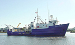 Pelican |
| Survey Equipment | Survey Info | Data Type(s) | Data Collected |
|---|---|---|---|
| Multichannel seismics | --- | Multichannel | |
| Sparker | --- | Sparker |
