Other ID: none
Status: Completed
Organization(s): USGS, Woods Hole Coastal and Marine Science Center
Funding Program(s):
Principal Investigator(s): William Schwab, Laura Brothers
Affiliate Investigator(s):
Information Specialist(s): Seth Ackerman
Data Type(s): Sonar: Interferometric, Location-Elevation: Navigation, Sonar: Sound Velocity, Seismics: Sub Bottom Profiler, Sonar: Sidescan
Scientific Purpose/Goals: Characterize seabed in state waters south of Martha's Vineyard
Vehicle(s):
Start Port/Location: Woods Hole, MA
End Port/Location: Woods Hole, MA
Start Date: 2013-05-20
End Date: 2013-06-13
Equipment Used: Edgetech chirp subbottom profiler 512i, SEA SWATHplus-M 234 kHz, DGPS, HYPACK, Sensor - MVP30 (Odim), Sensor - SVP, Real Time Kinematic GPS, Edgetech 4200 sidescan
Information to be Derived: Sea floor map;Bathymetric maps;
Summary of Activity and Data Gathered: Mapped 180 km2 of seafloor South of Marthas Vineyard and in Nantucket Sound. Data collected included bathymetry, sub bottom and sonar.
Staff: Seth Ackerman, Brian Andrews, Wayne Baldwin, Emile Bergeron, William Danforth, David Foster, Eric Moore, Charles Worley
Affiliate Staff:
Notes: Continuation of MassCZM mapping cooperative
Project = MCZM/B. Bay & Vineyard Sound,
Location:
Marthas Vineyard Inner shelf & Nantucket Sound, Massachusetts, United States, North America, North Atlantic
| Boundaries | |||
|---|---|---|---|
| North: 41.390816 | South: 41.192901 | West: -70.810609 | East: -70.029975 |
Platform(s):
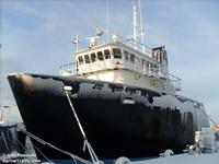 Scarlett Isabella |
Ackerman, S.D., Brothers, L.L., Foster, D.S., Andrews, B.D., Baldwin, W.E., and Schwab, W.C., 2016, High-resolution geophysical data from the inner continental shelf—South of Martha's Vineyard and north of Nantucket, Massachusetts: U.S. Geological Survey Open-File Report 2016–1168, 21 p., https://doi.org/10.3133/ofr20161168.
Pendleton, E.A., Baldwin, W.E., Ackerman, S.D., Foster, D.S., Andrews, B.D., Schwab, W.C., and Brothers, L.L., 2019, Shallow Geology, Sea-Floor Texture, and Physiographic Zones of the Inner Continental Shelf from Aquinnah to Wasque Point, Martha's Vineyard, and Eel Point to Great Point, Nantucket, Massachusetts: U.S. Geological Survey Open-File Report 2018-1181, https://doi.org/10.3133/ofr20181181.
Pendleton, E.A., Baldwin, W.E., Foster, D.F., Ackerman, S.D., Andrews, B.D., Brothers, L.L., and Schwab, W.C., 2018, Geospatial data layers of shallow geology, sea-floor texture, and physiographic zones from the inner continental shelf of Martha's Vineyard from Aquinnah to Wasque Point, and Nantucket from Eel Point to Great Point: U.S. Geological Survey data release, https://doi.org/10.5066/P9E9EFNE.
| Survey Equipment | Survey Info | Data Type(s) | Data Collected |
|---|---|---|---|
| Edgetech chirp subbottom profiler 512i | --- | Sub Bottom Profiler | |
| SEA SWATHplus-M 234 kHz | --- | Interferometric | |
| DGPS | --- | Navigation | |
| HYPACK | --- | Navigation | |
| Sensor - MVP30 (Odim) | --- | Sound Velocity | |
| Sensor - SVP | --- | Sound Velocity | |
| Real Time Kinematic GPS | --- | Navigation | |
| Edgetech 4200 sidescan | --- | Sidescan |
