Other ID: none
Status: Completed
Organization(s): USGS, Woods Hole Coastal and Marine Science Center
Funding Program(s):
Principal Investigator(s): Christopher Sherwood
Affiliate Investigator(s): Gali Kineke - Boston College; Rocky Geyer - WHOI; Dave Ralston - WHOI
Information Specialist(s): Patrick Dickhudt
Data Type(s): Imagery: Photo, Imagery: Video, Location-Elevation: Navigation, Sampling: Geology
Scientific Purpose/Goals: Obtain core samples, conduct erosion chamber analyses. Conduct sediment camera survey.
Vehicle(s):
Start Port/Location: Old Saybrook, CT
End Port/Location: Old Saybrook, CT
Start Date: 2013-05-13
End Date: 2013-05-17
Equipment Used: Video camera - deep sea, Sediment camera, GPS (wh), Slow corer
Information to be Derived: Grain size analysis;Suspended sediment concentrations;Physical property data;
Summary of Activity and Data Gathered: Obtained cores and performed erosion-chamber measurements at three sites (2 measurements each) and sediment-camera images at >1000 sites. Grab samples at six sites for sediment-camera calibartion.
Staff: Dann Blackwood, Patrick Dickhudt
Affiliate Staff:
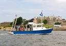
Notes: Coordinated with Boston Colleg and WHOI scientists, aboard RV Lowell Weicker and RV Mytelis.
OT waiver approved.
Location:
Connecticut River, Connecticut, United States, North America, North Atlantic
| Boundaries | |||
|---|---|---|---|
| North: 41.4139 | South: 41.252 | West: -72.4507 | East: -72.26257 |
Platform(s):
 Lowell Weicker |
| Survey Equipment | Survey Info | Data Type(s) | Data Collected |
|---|---|---|---|
| Video camera - deep sea | --- | Video | |
| Sediment camera | --- | Photo | |
| GPS (wh) | --- | Navigation | |
| Slow corer | --- | Geology |
