Other ID: none
Status: Completed
Organization(s): USGS, Woods Hole Coastal and Marine Science Center
Funding Program(s): Coastal Model Applications and Field Measurements (LQ00DYN)
Principal Investigator(s): Christopher Sherwood
Affiliate Investigator(s): Malcolm Scully, WHOI
Information Specialist(s): Ellyn Montgomery
Data Type(s): Location-Elevation: Navigation, Time Series: Mooring (physical oceanography)
Scientific Purpose/Goals: Instrument recovery. Instrumentation test follow on to 2014 MVCO experiment.
Vehicle(s):
Start Port/Location: Woods Hole, MA
End Port/Location: Woods Hole, MA
Start Date: 2015-12-14
End Date: 2015-12-14
Equipment Used: Bottom platform, Other
Information to be Derived: oceanographic time series
Summary of Activity and Data Gathered: One quadpod and one NIMBBLE sled were deployed for engineering tests
Staff: Dann Blackwood, Jonathan Borden, Sandra Brosnahan, Christopher Sherwood, Steven Suttles
Affiliate Staff:
Notes: Entries for this field activity are associated with Field Activity 2015-072-FA.
Nick DiCosmo was aboard...not in pull-down list yet.
Data is available at: http://dx.doi.org/10.5066/F7736P28
Location:
MVCO, Massachusetts, United States, Atlanctic Ocean
| Boundaries | |||
|---|---|---|---|
| North: 41.3564774 | South: 41.25294098 | West: -70.7865 | East: -70.3989094 |
Platform(s):
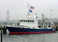
 Tioga |
Martini, M.A., Montgomery, E.T. and Sherwood, C.R., 2017, Oceanographic and water-quality measurements collected south of Martha's Vineyard, MA, November - December 2015: U.S. Geological Survey data release, https://doi.org/10.5066/F7736P28.
| Survey Equipment | Survey Info | Data Type(s) | Data Collected |
|---|---|---|---|
| Bottom platform | --- | Mooring (physical oceanography) | |
| Other | --- | --- | --- |