Other ID: none
Status: Completed
Organization(s): USGS, Woods Hole Coastal and Marine Science Center
Funding Program(s):
Principal Investigator(s): William Schwab
Affiliate Investigator(s):
Information Specialist(s): Wayne Baldwin
Data Type(s): Location-Elevation: Navigation, Sampling: Geology, Seismics: Sub Bottom Profiler, Sonar: Multibeam
Scientific Purpose/Goals: Map sediment distribution in selected areas south of Fire Island
Vehicle(s):
Start Port/Location: Woods Hole, MA
End Port/Location: Woods Hole, MA
Start Date: 2014-10-14
End Date: 2014-10-28
Equipment Used: Other, SeaBOSS, DGPS, Real Time Kinematic GPS, Reson T20-P, Edgetech chirp subbottom profiler 512i
Information to be Derived: Grain size analysis; sub-bottom profiling
Summary of Activity and Data Gathered: Grab samples, bottom video and photographs and seismic reflection data were collected during 2014-009-FA.
Staff: Wayne Baldwin, David Foster, Eric Moore, Alexander Nichols, William Schwab, Charles Worley
Affiliate Staff:
Notes: Project = Sandy Suppl. Fire Island
OT = 44 hrs/wk
Location:
New York Bight, New York, New Jersey, United States, North America, North Atlantic
| Boundaries | |||
|---|---|---|---|
| North: 40.7431 | South: 40.59725 | West: -73.309 | East: -72.70175 |
Platform(s):
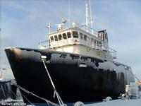 Scarlett Isabella |
Denny, J.F., Schwab, W.C., Ackerman, S.D., Baldwin, W.E., Danforth, W.W., Moore, E., Nichols, A.R., and Worley, C.R., 2017, High-resolution geophysical and sample data collected offshore of Fire Island, New York in 2014, U.S. Geological data release, https://doi.org/10.5066/F7FF3QTQ.
Schwab, W.C., Baldwin, W.E., Warner, J.C., List, J.H., Denny, J.F., Liste, M., and Safak, I., 2017, Change in morphology and modern sediment thickness on the inner-continental shelf offshore of Fire Island, New York between 2011 and 2014—Assessing the effect of hurricane impact: Marine Geology, v. 391, p. 48-64, https://doi.org/10.1016/j.margeo.2017.07.010.
| Title | Survey Equipment | Description |
|---|---|---|
| Cruise log | (document not focused on specific equipment) | Acquisition log maintained in 2014 during the U.S. Geological Survey Field Activity 2014-009-FA conducted offshore of Fire Island, NY (Excel spreadsheet format) |
| Survey Equipment | Survey Info | Data Type(s) | Data Collected |
|---|---|---|---|
| Other | --- | --- | --- |
| SeaBOSS | The SeaBOSS was used to acquire grab sediment samples, bottom photographs and video to ground-truth the geophysics in 2014 during U.S. Geological Survey Field Activity 2014-009-FA offshore of Fire Island, NY. | Surveys (biological) Experiments (biological) Species ID Photo Video Geology Biology | 2014-009-FA_samples (Location and analysis of sediment samples collected in 2014 by the U.S. Geological Survey offshore of Fire Island, NY (Esri point shapefile, CGS WGS 84).) 2014-009-FA_videos (Location of sea floor video tracklines along with videos collected in 2014 by the U.S. Geological Survey offshore of Fire Island, NY (MP4 video files and Esri polyline shapefile, CGS WGS 84, MP4 files).) 2014-009-FA_photos (Location of bottom photographs along with images collected in 2014 by the U.S. Geological Survey offshore of Fire Island, NY (JPEG images and Esri point shapefile, CGS WGS 84).) |
| DGPS | Navigation data were used to supply positioning information to geophysical and sampling systems in 2014 during U.S. Geological Survey Field Activity 2014-009-FA offshore of Fire Island, NY. | Navigation | 2014-009-FA_hypack (Text files of the navigation logged by HYPACK in 2014 during the U.S. Geological Survey offshore of Fire Island, NY (Hypack ASCII Text Files, CGS WGS 84).) |
| Real Time Kinematic GPS | Navigation data were used to supply positioning information to geophysical and sampling systems in 2014 during U.S. Geological Survey Field Activity 2014-009-FA offshore of Fire Island, NY. | Navigation | |
| Reson T20-P | The Teledyne Reson T20-P multibeam echosounder was tested in 2014 during U.S. Geological Survey Field Activity 2014-009-FA offshore of Fire Island, NY. No usable data were collected due to hardware and software malfunctions. | Multibeam Water column reflectivity | No data was collected |
| Edgetech chirp subbottom profiler 512i | Edgetech SB-512i chirp subbottom profiler was used to acquire approximately 745 km of seismic data in 2014 during U.S. Geological Survey Field Activity 2014-009-FA offshore of Fire Island, NY. | Sub Bottom Profiler | 2014-009-FA_512i_Images (PNG images of Edgetech SB-512i chirp seismic-reflection data collected in 2014 by the U.S. Geological Survey offshore of Fire Island, NY in 2014 (PNG format).) 2014-009-FA_512i_Tracklines (Trackline navigation for the EdgeTech SB-512i chirp seismic-reflection data collected in 2014 by the U.S. Geological Survey offshore of Fire Island, NY (Esri polyline shapefile, GCS WGS 84).) 2014-009-FA_512i_500sht (Shot point navigation at even 500-shot intervals for the EdgeTech SB-512i chirp seismic-reflection data collected in 2014 by the U.S. Geological Survey offshore of Fire Island, NY (Esri point shapefile, CGS WGS 84).) |
