Other ID: none
Status: Completed
Organization(s): USGS, Woods Hole Coastal and Marine Science Center
Funding Program(s): Other (Other)
Principal Investigator(s): Laura Brothers, E. Robert Thieler
Affiliate Investigator(s):
Information Specialist(s): Elizabeth Pendleton
Data Type(s): Imagery: Photo, Imagery: Video, Location-Elevation: Navigation, Sampling: Geology, Seismics: Boomer, Seismics: Multichannel, Seismics: Sub Bottom Profiler, Sonar: Interferometric, Sonar: Sidescan, Sonar: Sound Velocity
Scientific Purpose/Goals: map inner shelf bathymetry, surficial sediment type, geologic framework
Vehicle(s):
Start Port/Location: Ocean City, MD
End Port/Location: Norfolk, VA
Start Date: 2015-06-08
End Date: 2015-07-17
Equipment Used: Edgetech chirp subbottom profiler 512i, GoPro camera, SEA SWATHplus-M 234 kHz, Sensor - MVP30 (Odim), GeoEel 16-channel hydrophone, Other, Edgetech 4200 sidescan, Real Time Kinematic GPS, Van Veen grab sampler, S-Boom seismic source
Information to be Derived: Sea floor map;Bathymetric maps; sub subsurface data
Summary of Activity and Data Gathered: Collected 5,516 km of geophysical tracklines. 125 grab samples
Staff: Seth Ackerman, Brian Andrews, Wayne Baldwin, Emile Bergeron, Laura Brothers, William Danforth, David Foster, Eric Moore, Alexander Nichols, Charles Worley, Other
Affiliate Staff:
Notes: Other instrumentation: Edgetech 512i
Other Staffing: Jackson Curie from the PCMSC also participated in the field activity.
Inner shelf Delmarva peninsula, Cape Henlopen, DE to Fisherman Island, VA
Location:
Mid-Atlantic Bight, Delaware/Maryland/Virginia, United States, North America, North Atlantic
| Boundaries | |||
|---|---|---|---|
| North: 37.86714455 | South: 36.96062274 | West: -75.93200684 | East: -75.11474806 |
Platform(s):
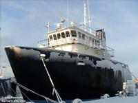 Scarlett Isabella |
Ellis, A.M., Shaw, J.E., Osterman, L.E., Smith, C.G.,, 2018, The Foraminifera of Chincoteague Bay, Assateague Island, and the Surrounding Areas: a Regional Distribution Study: Journal of Foraminiferal Research, v. 48 no. 3, pp. 223–240, doi: 10.2113/gsjfr.48.3.223.
Ellis, A.M., Wheaton, C.J., Smith, C.G., 2017, Archive of sediment physical properties and grain-size data for sediment samples collected offshore of Assateague Island, Maryland and Virginia: U.S. Geological Survey data release, https://doi.org/10.5066/F7HX19WB.
Brothers, L.L., Foster, D.S., Pendleton, E.A., Thieler, E.R., 2015, Distribution and Tentative Ages of an Extensive Paleochannel Network Offshore of the Delmarva Peninsula. [abs.]: , GSA 2015 Fall Annual Meeting. Baltimore, MD, November 1-4, 2015.
Foster, D.S., Brothers, L.L., Baldwin, W.E., and Pendleton, E.A., 2023, Geospatial data layers of shallow geology from the inner continental shelf of the Delmarva Peninsula, including Maryland and Virginia state waters: U.S. Geological Survey data release, https://doi.org/10.5066/P9GQY0ZN.
Pendleton, E.A., Sweeney, E.M., and Brothers, L.L., 2019, Optimizing an inner-continental shelf geologic framework investigation through data repurposing and machine learning: Geosciences, v. 9, issue 6, https://doi.org/10.3390/geosciences9050231.
Pendleton, E.A., Brothers, L.L., Sweeney, E.S., Thieler, E.R., and Foster, D.S., 2017, Sediment texture and geomorphology of the sea floor from Fenwick Island, Maryland to Fisherman's Island, Virginia: U.S. Geological Survey data release, https://doi.org/10.5066/F78K779J.
Sweeney, E.M., Pendleton, E.A., Ackerman, S.D., Andrews, B.D., Baldwin, W.E., Danforth, W.W., Foster, D.S., Thieler, E.R., and Brothers, L.L., 2015, High-resolution geophysical data collected along the Delmarva Peninsula 2015, U.S. Geological Survey Field Activity 2015-001-FA (ver. 3.0, May 2016): U.S. Geological Survey data release, https://doi.org/10.5066/F7P55KK3.
Wehmiller, J.F., Brothers, L.L., Ramsey, K.W., Foster, D.S., Mattheus, C.R., Hein, C.J., Shawler, J.L., 2021, Molluscan aminostratigraphy of the US Mid-Atlantic Quaternary coastal system: Implications for onshore-offshore correlation, paleochannel and barrier island evolution, and local late Quaternary sea-level history: Quaternary Geochronology doi:10.1016/j.quageo.2021.101177.
FAN 2015-001-FA has data viewable in the CMGP Video and Photograph Portal. View the data in this application here. See the instructions for working with this application.
| Survey Equipment | Survey Info | Data Type(s) | Data Collected |
|---|---|---|---|
| Edgetech chirp subbottom profiler 512i | --- | Sub Bottom Profiler | 2015-001-FA_512i_track (Trackline navigation for EdgeTech SB-512i chirp seismic-reflection data collected in 2015 by the U.S. Geological Survey along the Delmarva Peninsula, MD and VA) 2015-001-FA_512i_images (PNG formatted images of EdgeTech SB-512i chirp seismic-reflection data collected in 2015 by the U.S. Geological Survey along the Delmarva Peninsula, MD and VA) |
| GoPro camera | Bottom photographs and sediment samples were acquired to validate the seafloor interpretations made from geophysical data. Often sediment samplers are unable to recover large-diameter particles, so photographs can document the seafloor character in areas where samples may not be obtained. Two GoPro cameras were mounted to a USGS SEABOSS (Mark II configuration) with a modified VanVeen sampler frame. Approximate SEABOSS dimensions are 115 X 115 X 117 cm. The Van Veen sampler is housed at the bottom and center of the frame at approximately 30 X 32 X 16 cm with a 1/10 sq. meter sample capacity. Two red lasers were mounted on the frame above the sampler, 20 cm apart for scale in bottom photographs. A Keldan (Advanced Lighting Technology) light was mounted at the top of the frame and aimed downward to illuminate the seabed for photographs. Two GoPro cameras were mounted on the frame and set to capture photographs at 2 or 5 second intervals. The GoPro Hero 2 was mounted approximately 70 cm from the bottom of the SEABOSS frame and captured photographs at 2-second interval. The GoPro Hero 3+ was mounted approximately 20 cm from the bottom of the SEABOSS frame and captured video and photographs at 5-second interval. Because the frame was stationary on the bottom of the seabed only one photograph for each camera was chosen to represent the seafloor at each station location. Photographs collected in the water column, on the ship's deck, and duplicate photos of the seafloor were deleted. The Hero 2 field of view includes the Hero 3 GoPro (furthest to the right) and 2 instruments that were attached to the SEABOSS for additional data. The instrument to the left is a Suunto SK-7 dive compass, which shows the orientation of the SEABOSS. The digital readout to the right of the dive compass is the Uwatec dive timer, which shows 4 readouts: upper left is depth in meters, lower left is max depth in meters, upper right is dive time in minutes and lower right is temperature in Celsius (during ascent, this changes to ascent rate in meters per minute and shows an arrow when it senses the rate is too fast). | Photo Video | 2015-001-FA_Photos (Location of bottom photographs along with images collected by the U.S. Geological Survey in 2015 along the Delmarva Peninsula, MD, and VA) |
| SEA SWATHplus-M 234 kHz | These swath interferometric bathymetry data were collected to identify sea-floor morphology. | Interferometric | 2015-001-FA_bathytracks (Trackline navigation for swath interferometric bathymetry data collected in 2015 by the U.S. Geological Survey along the Delmarva Peninsula, MD and VA) 2015-001-FA_bathy (Bathymetric data from swath interferometric bathymetry data. Bathymetric data are useful geophysical datasets for geologic framework studies. These data can be used in conjunction with other geophysical and sample data to identify sea-floor morphology.) |
| Sensor - MVP30 (Odim) | These data were deployed to correct sound velocity artifacts in bathymetery data | Sound Velocity | 2015-001-FA_MVP-SVP_data (Location of sound velocity profiles along with profile plots collected in 2015 by the U.S. Geological Survey along the Delmarva Peninsula, MD, and VA (PNG images, CSV text, ASVP text, and Esri point shapefile, GCS WGS 84)) |
| GeoEel 16-channel hydrophone | These seismic reflection profile data were collected to image the sediment layers beneath the seafloor. | Multichannel | 2015-001-FA_MCS (multi-channel streamer seismic-reflection profiles collected in 2015 by the U.S. Geological Survey along the Delmarva Peninsula, MD, and VA.) 2015-001-FA_MCS_100rp (Reflection point navigation for multi-channel streamer seismic-reflection profiles collected in 2015 by the U.S. Geological Survey along the Delmarva Peninsula, MD and VA) 2015-001-FA_MCS_tracks (Trackline navigation for multi-channel streamer seismic-reflection profiles collected in 2015 by the U.S. Geological Survey along the Delmarva Peninsula, MD and VA) |
| Other | --- | --- | --- |
| Edgetech 4200 sidescan | Sidescan sonar data were collected with an Edgetech 4200 dual frequency (100/410 kHz) frequency modulated sidescan-sonar towfish on the M/V Scarlet Isablella. The sonar was towed from the stern A-frame of the vessel. A 3PS digital block cable counter was used to measure the amount of tow cable deployed, and cable out values were transmitted via serial connection to the Edgetech Discover (version 34.0.1.106) acquisition software (lines L40F1 to L47F1) and SonarWiz software (version 6.01.0009) (lines L47F3 to L183-20150714_134804) on the sonar acquisition computer for layback calculation. Tracklines are generally spaced 200m apart. | Sidescan | 2015-001-FA_ssstracks (Trackline navigation for Edgetech 4200 sidescan sonar data collected in 2015 by the U.S. Geological Survey along the Delmarva Peninsula, MD and VA) 2015-001-FA_sss (1-meter resolution sidescan-sonar mosaic image collected by the U.S. Geological Survey along the Delmarva Peninsula, MD and VA in 2015) |
| Real Time Kinematic GPS | Navigation data were collected to provide spatial navigation for bathymetric data collection and to spatially correlate the bathymetric data with other data in the GIS. | Navigation | 2015-001-FA_HYPACK (Text files of the navigation logged with HYPACK Software during survey 2015-001-FA conducted along the Delmarva Peninsula, MD, and VA by the U.S. Geological Survey in 2015.) |
| Van Veen grab sampler | Bottom photographs and sediment samples were acquired to validate the seafloor interpretations made from geophysical data. Often sediment samplers are unable to recover large-diameter particles, so photographs can document the seafloor character in areas where samples may not be obtained. Two GoPro cameras were mounted to a USGS SEABOSS (Mark II configuration) with a modified VanVeen sampler frame. Approximate SEABOSS dimensions are 115 X 115 X 117 cm. The Van Veen sampler is housed at the bottom and center of the frame at approximately 30 X 32 X 16 cm with a 1/10 sq. meter sample capacity. Two red lasers were mounted on the frame above the sampler, 20 cm apart for scale in bottom photographs. A Keldan (Advanced Lighting Technology) light was mounted at the top of the frame and aimed downward to illuminate the seabed for photographs. Two GoPro cameras were mounted on the frame and set to capture photographs at 2 or 5 second intervals. Samples were recovered when the frame was lifted off the seabed and triggered the Van Veen sampler to close. | Geology | 2015-001-FA_Samples (Location and analyses of sediment samples collected by the U.S. Geological Survey in 2015 along the Delmarva Peninsula, MD, and VA) |
| S-Boom seismic source | MCS seismic data were collected using S-Boom source and a 100-m long GeoEel 16-channel streamer. The applied acoustics S-Boom source was towed astern of the M/V Scarlet Isabella at a power level of 400 joules. The Geometrics GeoEel, 16-channel liquid filled digital streamer was towed from the starboard side of the vessel, and the center of the first channel of the active section was 10 to 20 meters aft of the boomer source. The streamer had a group interval of 3.25 meters connected to Geometrics Streamer Power Supply Unit (SPSU). Data were acquired in Geometrics SEG-D format on Windows PC controller system using Geometrics CNT-1 software. The fire rate was 1 s, the record length was 250 ms and the sample interval was 0.25 ms. | Boomer | No data was collected |
