Other ID: 15CCT02, 15CCT03, 15CCT04, 15CCT05
Status: Completed
Organization(s): USGS, St. Petersburg Coastal and Marine Science Center
Funding Program(s): Sea-level and Storm Impacts on Estuarine Environments and Shorelines - SSIEES (GX.18.MN00.F1M10.00)
Principal Investigator(s): Terrence McCloskey, Christopher Smith
Affiliate Investigator(s):
Information Specialist(s): Nancy DeWitt
Data Type(s): Location-Elevation: Navigation, Sampling: Geology, Seismics: Sub Bottom Profiler, Sonar: Sidescan, Sonar: Single Beam, Sonar: Sound Velocity
Scientific Purpose/Goals: To collect sediment cores and geophysical data to assess marsh history.
Vehicle(s): Ford F-350 Dually Silver (GSA)
Start Port/Location: St. Petersburg, FL
End Port/Location: St. Petersburg, FL
Start Date: 2015-05-27
End Date: 2015-06-06
Equipment Used: ODOM-Echotrac CV-100, Ashtech ProFlex 800 GNSS Receiver, Ashtech Z-Xtreme DGPS, Choke Ring Antenna, Collapsible Tripod, Garmin GPS, GPS , GPS Pole, Grab Sampler, Peat Corer, Chirp 424, Other, Klein Side Scan, Valeport SVP
Information to be Derived: core descriptons, bulk density, LOI, Pb-210, Cs-137, foram assemblages, bathymetry xyz, bathymetry grids, sub bottom profiles, side scan sonar mosaic
Summary of Activity and Data Gathered: 0 sediment cores; 127 chirp subbottom profile lines; 144 XTF and 142 SDF line files of SSS; 304 lines of SBB; 87 SVP; 335 SBB waveform files in DSO format recorded using eChart and 275 in BIN format recorded in HYPACK, 32 ponars, 5 marsh samples, 25 radium samples, 20+ foram samples; 4 days of continuous radon in water measurements and 1.5 days of continuous radon in air measurements.
Staff: Nancy DeWitt, Joseph Fredericks, Chelsea Kuhs, Stanley Locker, Terrence McCloskey, Christopher Smith, Cathryn Wheaton
Affiliate Staff:
Notes: 15CCT02 = Sediment Sampling;
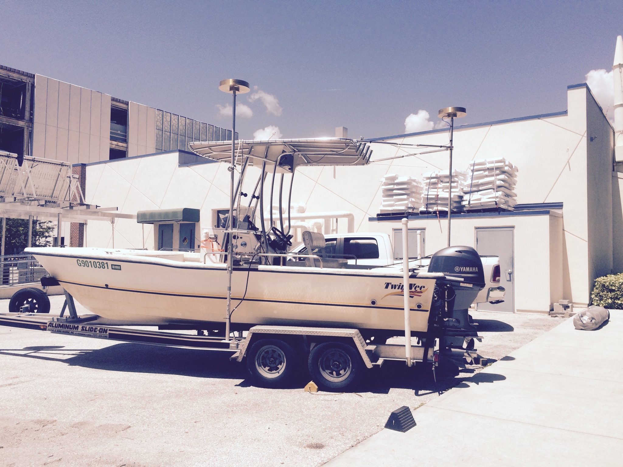
15CCT03 = Twin Vee = RV Jabba Jaw collecting sub-bottom profiler and side scan sonar;
15CCT04 = Jet Ski = RV Chum (blue)collecting Single beam bathymetry;
14CCT04 = Jet Ski = RV Shark (white)collecting Single beam bathymetry
Sediment Samples are staged to be archived and are on the East Wall of the Sed Lab as of July 18th, 2018.
Location:
Grand Bay, AL/MS and Pascaguola, MS
| Boundaries | |||
|---|---|---|---|
| North: 30.42732018 | South: 30.2790872 | West: -88.5373 | East: -88.30902148 |
Platform(s):
 Mako (SP) |  Personal Water Craft (White WVR1 - Shark) |  Twin Vee (Jabba Jaw) |
DeWitt, N.T., Stalk, C.A., Smith, C.G., Locker, S.D., Fredericks, J.J., McCloskey, T.A., Wheaton, C.J., 2017, Single-beam bathymetry data collected in 2015 from Grand Bay, Alabama-Mississippi: U.S. Geological Survey Data Series 1070, https://doi.org/10.3133/ds1070.
DeWitt, N.T., Stalk, C.A., Smith, C.G., Locker, S.D., Fredericks, J.J., McCloskey, T.A., Wheaton, C.J., 2016, Single-beam bathymetry data collected in 2015 from Grand Bay, Mississippi/Alabama: U.S. Geological Survey data release, https://doi.org/10.5066/F7NP22M2.
Jenkins, R.L., III, Passeri, D.L., Smith, C.G., Thompson, D.M., 2023, Modeling the Effects of Interior Headland Restoration on Estuarine Sediment Transport Processes in a Marine-Dominant Estuary: Delft3D Model Output: U.S. Geological Survey data release, https://doi.org/10.5066/P986ZR6B.
Jenkins, R.L., Passeri, D.L., Smith, C.G., Thompson, D.M., Smith, K.E.L., 2023, Modeling the effects of interior headland restoration on estuarine sediment transport processes in a marine-dominant estuary: Frontiers in Marine Science, v. 10, doi: 10.3389/fmars.2023.1217830.
Locker, S.D., Forde, A.S., Smith, C.G., 2018, Subbottom and sidescan sonar data acquired in 2015 from Grand Bay, Mississippi and Alabama: U.S. Geological Survey data release, https://doi.org/10.5066/P9374DKQ.
Marot, M.E., Smith, C.G., McCloskey, T.A., Locker, S.D., Khan, N.S., Smith, K.E.L., 2020, Sedimentary data from Grand Bay, Alabama/Mississippi, 2014-2016 (Version 1.1): U.S. Geological Survey data release, https://doi.org/10.5066/P9FO8R3Y.
Marot, M.E., Smith, C.G., McCloskey, T.A., Locker, S.D., Khan, N.S., Smith, K.E.L., 2019, Sedimentary Data from Grand Bay, Alabama/Mississippi, 2014-2017: U.S. Geological Survey data release, https://doi.org/10.5066/P9FO8R3Y.
| Survey Equipment | Survey Info | Data Type(s) | Data Collected |
|---|---|---|---|
| ODOM-Echotrac CV-100 | --- | Single Beam | Grand_Bay_2015_NAD83_MLLW_10m_DEM.zip (Bathymetry DEM, 10-m cell size) Grand_Bay_2015_NAD83_MLLW_30m_DEM.zip (Bathymetry DEM, 30-m cell size) 2015-315-FA_SBB_XYZ.zip (Single-beam soundings, includes Grand_Bay_2015_SBB_ITRF00.txt, Grand_Bay_2015_SBB_NAD83_MLLW.txt, and Grand_Bay_2015_SBB_NAD83_NAVD88_GEOID12A.txt) Grand_Bay_2015_SBB_tracklines.zip (Single-beam tracklines) |
| Ashtech ProFlex 800 GNSS Receiver | --- | Benchmarks Navigation | |
| Ashtech Z-Xtreme DGPS | --- | Benchmarks Navigation | |
| Choke Ring Antenna | --- | Benchmarks Navigation | |
| Collapsible Tripod | --- | Benchmarks Navigation Profiles Transects | |
| Garmin GPS | --- | Navigation | |
| GPS | --- | Navigation | |
| GPS Pole | --- | Navigation Profiles Transects | |
| Grab Sampler | --- | Biology Geology | |
| Peat Corer | --- | Biology Geology | |
| Chirp 424 | --- | Sub Bottom Profiler | 2015-315-FA_arc.zip (Survey trackline locations) 2015-315-FA_segy.zip (Unprocessed digital chirp subbottom trace data) |
| Other | --- | --- | --- |
| Klein Side Scan | --- | Sidescan | 2015-315-FA_xtf.zip (Unprocessed Klein SonarPro xtf data files) 2015-315-FA_SSSMosaic. zip (Processed sidescan sonar backscatter imagery merged into a mosaic at 30 centimeter pixel resolution. NOTE: Backscatter intensity is represented by a gray-scale pallet with high backscatter intensities as darker grays ) |
| Valeport SVP | --- | Sound Velocity |