AKA: CCE Deployment 2015
Other ID: none
Status: Completed
Organization(s): Other
Funding Program(s): Other (Other), Sediment Transport in Coastal Environments (ZP00FDB)
Principal Investigator(s): Katherine Coble, Joanne Thede, Kurt Rosenberger
Affiliate Investigator(s): Charles K. Paull (MBARI)
Information Specialist(s): Katherine Coble, Joanne Thede, Kurt Rosenberger
Data Type(s): Location-Elevation: Navigation, Sampling: Geology, Time Series: Mooring (physical oceanography)
Scientific Purpose/Goals: Coordinated Canyon Experiment - initial deployment of moorings (MS1, 2, & 3) and MBARI instrumentation in the upper canyon
Vehicle(s): None
Start Port/Location: Moss Landing, CA
End Port/Location: Moss Landing, CA
Start Date: 2015-10-05
End Date: 2015-10-06
Equipment Used: navigation, Sediment trap, Moorings - Tripods
Information to be Derived: Deployment of three moorings in upper Monterey Canyon as part of the CCE
Summary of Activity and Data Gathered: Data submitted for FAD; recovered on 2016-610-FA Mooring numbers: CCE15M1A CCE15M2A CCE15M3A USGS personnel at sea included Kurt Rosenberger, Joanne Ferreira, Cordell Johnson, Peter Dal Ferro, Jenny White, Katherine Coble. MS2 and MS3 deployed 10/5; MS1 deployed 10/6. Successful deployment completed ahead of schedule.
Staff: Jennifer White
Affiliate Staff:
Notes: This was a joint field operation with MBARI as part of the CCE. WinFrog nav.
moorings were recovered on 2016-610-FA
Location:
Monterey Canyon, Monterey Bay, California, United States, Pacific Ocean
| Boundaries | |||
|---|---|---|---|
| North: 36.8408706 | South: 36.73227062 | West: -121.977 | East: -121.81406555 |
Platform(s):
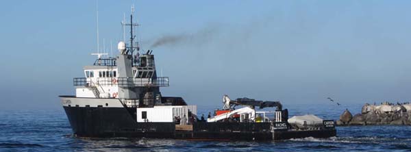 Rachel Carson (MBARI) |
Ferreira, J.T., Rosenberger, K.J., and Maier, K.L., 2019, Time-series oceanographic data from the Monterey Canyon, CA October 2015 - March 2017: U.S. Geological Survey data release.
| Survey Equipment | Survey Info | Data Type(s) | Data Collected |
|---|---|---|---|
| navigation | --- | Navigation | |
| Sediment trap | --- | Sediment Properties Geology | |
| Moorings - Tripods | --- | Mooring (physical oceanography) |
