AKA: none
Other ID: none
Status: Completed
Organization(s): USGS, Pacific Coastal and Marine Science Center
Funding Program(s): Sediment Transport in Coastal Environments (ZP00FDB)
Principal Investigator(s): Jessica Lacy
Affiliate Investigator(s):
Information Specialist(s): Jessica Lacy
Data Type(s): Location-Elevation: Navigation, Location-Elevation: Transects, Sonar: Single Beam
Scientific Purpose/Goals: Baseline Topographic and Bathymetric survey of Little Holland Tract
Vehicle(s): MarFac; Chevy Suburban - gray; 7 pass; G62-2874L
Start Port/Location: Rio Vista, CA
End Port/Location: Rio Vista, CA
Start Date: 2015-05-22
End Date: 2015-07-31
Equipment Used: Trimble R7 GPS (AS), Waverunners
Information to be Derived: Combined topographic/bathymetric map of Little Holland Tract.
Summary of Activity and Data Gathered: A. Stevens submitted base, bathy, photos, svp, and topo with readme file 6/12/15. A. Snyder submitted gis folder to FAD 9/28/2015
Staff: Timothy Elfers, Cordell Johnson, Alexander Snyder, Andrew Stevens
Affiliate Staff:
Notes: First day in field is for topographic surveys and to recon for appropriate bathy survey vessel. Follow-up field days to finish topo and bathy
Location:
Rio Vista, CA Little Holland Tract, Sacramento River Delta
| Boundaries | |||
|---|---|---|---|
| North: 38.39226254 | South: 38.26247087 | West: -121.708 | East: -121.63314819 |
Platform(s):
 Fast Eddy (SC) |  Waverunner 1 (SC) | Waverunner 2 (SC) | 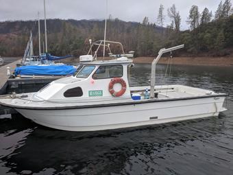 San Lorenzo |
Fregoso, T.A., Stevens, A.W., Wang, R.-F., Handley, T., Dartnell, P., Lacy, J.R., Ateljevich, E., and Dailey, E.T., 2020, Bathymetry, topography, and acoustic backscatter data, and a digital elevation model (DEM) of the Cache Slough Complex and Sacramento River Deep Water Ship Channel, Sacramento-San Joaquin Delta, California: U.S. Geological Survey data release, https://doi.org/10.5066/P9AQSRVH.
Snyder, A., Stevens, A., Carlson, E., and Lacy, J., 2016, Digital Elevation Model of Little Holland Tract, Sacramento-San Joaquin Delta, California, 2015: U.S. Geological Survey data release.
Snyder, A.G., Lacy, J.R., Stevens, A.W., and Carlson, E.M., 2016, Bathymetric survey and digital elevation model of Little Holland Tract, Sacramento-San Joaquin Delta, California: U.S. Geological Survey Open-File Report 2016-1093.
| Survey Equipment | Survey Info | Data Type(s) | Data Collected |
|---|---|---|---|
| Trimble R7 GPS (AS) | --- | Benchmarks Navigation Profiles Transects | Digital elevation model of Little Holland Tract, Sacramento-San Joaquin Delta, California, 2015 (This product is a digital elevation model (DEM) for the Little Holland Tract in the Sacramento-San Joaquin River Delta, California based on U.S. Geological Survey (USGS)-collected elevation data, merged with existing topographic and bathymetric elevation data. The USGS collected topographic and bathymetric elevation data in 2015, using a combination of methods. Topographic and shallow-water bathymetric data were collected on foot using a global positioning system (GPS) backpack platform that consisted of survey-grade Trimble R10, and Trimble R7 global navigation satellite system (GNSS) receivers with Zephyr 2 antennas. Bathymetric data were collected using a personal watercraft (PWC) platform that consisted of Trimble R7 GNSS receivers with Zephyr 2 antennas, combined with Odom Echotrac CV-100 single-beam echosounders and 200 kHz transducers. The USGS elevation data were merged with topographic aerial Light Detection and Ranging (lidar) data collected by California Department of Water Resources (DWR) in 2007 and single-beam bathymetric data collected by Environmental Data Solutions (EDS) in 2009 to generate the final DEM. The GeoTIFF raster and comma-delimited text files are available for download at http://doi.org/10.5066/F7RX9954.) topo data (published in Science Base, U.S. Geological Survey data release, DOI: 10.5066/F7RX9954) |
| Waverunners | --- | Navigation Single Beam | bathy data (published in Science Base; U.S. Geological Survey data release, DOI: 10.5066/F7RX9954) |
