AKA: none
Other ID: none
Status: Completed
Organization(s): USGS, Pacific Coastal and Marine Science Center
Funding Program(s): Coastal and marine earthquake, tsunami, and landslide active margin field studies (ZP00EQV)
Principal Investigator(s): Daniel Brothers
Affiliate Investigator(s):
Information Specialist(s): James Conrad
Data Type(s): Location-Elevation: Navigation, Seismics: Multichannel, Seismics: Sub Bottom Profiler
Scientific Purpose/Goals: mapping; sub bottom data Queen Charlotte Fairweather fault
Vehicle(s):
Start Port/Location:
End Port/Location:
Start Date: 2015-08-01
End Date: 2015-08-25
Equipment Used: navigation, Multichannel, Other, 512 chirp, 512 chirp-source
Information to be Derived: sub bottom data Queen Charlotte Fairweather fault
Summary of Activity and Data Gathered: Gyre2015 Raw and Processed data submitted to FAD 10/6/2015
Staff:
Affiliate Staff:
Notes:
Location:
AK
| Boundaries | |||
|---|---|---|---|
| North: 59.06527196 | South: 57.66358556 | West: -138.0440712 | East: -134.46681976 |
Platform(s):
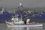
 Alaskan Gyre |
Balster-Gee, A.F., Brothers, D.S., Conrad, J.E., Kluesner, J.W., Hart, P.E., and Haeussler, P.J., 2017, Multichannel minisparker and chirp seismic-reflection data of field activity 2015-651-FA; Chatham Strait and Cross Sound, southeastern Alaska from 2015-08-03 to 2015-08-21: U.S. Geological Survey data release.
| Survey Equipment | Survey Info | Data Type(s) | Data Collected |
|---|---|---|---|
| navigation | --- | Navigation | |
| Multichannel | --- | Multichannel | Multichannel minisparker seismic-reflection data of field activity 2015-651-FA, Chatham Strait and Cross Sound, southeastern Alaska from 2015-08-03 to 2015-08-21 (This data release contains high-resolution multichannel seismic (MCS) reflection data collected in August of 2015 to explore marine geologic hazards of inland waterways of southeastern Alaska. Sub-bottom profiles were acquired in the inland waters between Glacier Bay and Juneau, including Cross Sound and Chatham Strait. High-resolution seismic-reflection profiles were acquired to assess evidence for active seabed faulting and submarine landslide hazards. The data were collected aboard the US Geological Survey R/V Alaskan Gyre. The seismic-reflection data were acquired using a 500-Joule minisparker source and a 48-channel Geometrics GeoEel digital streamer. Subbottom acoustic penetration spans up to several hundreds of meters, and is variable by location. This data release contains CMP sorted digital data in SEG-Y format.
This data release will be updated as subsequent lines of data from this field activity are published.) |
| Other | --- | --- | --- |
| 512 chirp | --- | Sub Bottom Profiler | Chirp seismic-reflection data of field activity 2015-651-FA, Chatham Strait and Cross Sound, southeastern Alaska from 2015-08-03 to 2015-08-21 (This data release contains high-resolution seismic reflection data collected in August of 2015 to explore marine geologic hazards of inland waterways of southeastern Alaska. Sub-bottom profiles were acquired in the inland waters between Glacier Bay and Juneau, including Cross Sound and Chatham Strait. High-resolution seismic-reflection profiles were acquired to assess evidence for active seabed faulting and submarine landslide hazards. The data were collected aboard the US Geological Survey R/V Alaskan Gyre. The seismic-reflection data were acquired using a tow-fish Edgetech 512 chirp subbottom profiler. Subbottom acoustic penetration spans up to several tens of meters, and is variable by location. This data release contains processed digital SEG-Y.
This data release will be updated as subsequent lines of data from this field activity are published.) |
| 512 chirp-source | --- | Sub Bottom Profiler |