AKA: none
Other ID: none
Status: Completed
Organization(s): USGS, Pacific Coastal and Marine Science Center
Funding Program(s): Coastal Habitats in Puget Sound (ZP00AZZ)
Principal Investigator(s): Melissa Foley, Jonathan Warrick
Affiliate Investigator(s): Jeff Duda, Sarah Moreley
Information Specialist(s): Melissa Foley
Data Type(s): Environmental Data: Chlorophyll, Environmental Data: Conductivity, Environmental Data: CTD, Environmental Data: Dissolved Oxygen, Environmental Data: Nutrients, Environmental Data: pH, Environmental Data: Sediment Properties, Environmental Data: Turbidity, Location-Elevation: Navigation, Sampling: Biology, Sampling: Chemistry, Time Series: Mooring (physical oceanography)
Scientific Purpose/Goals: Monitor the change in the river, estuary and nearshore following dam removal on the Elwha River
Vehicle(s): None
Start Port/Location: Port Angeles, WA
End Port/Location: Port Angeles, WA
Start Date: 2015-07-19
End Date: 2015-08-11
Equipment Used: Push corer, CTD, watersamples, CT, turbiditymeter, OBS, Nutrient sampler, navigation, water bottle, Moorings - Tripods
Information to be Derived: nutrient concentration, chlorophyll concentration, particulate organic matter concentration, invertebrate abundance
Summary of Activity and Data Gathered: Sample locations added to FAD 8/19/2015
Staff: Melissa Foley
Affiliate Staff:
Notes: Entries for this field activity are based on entries from Field Activity 2014-614-FA
Entries for this field activity are based on entries from Field Activity 2014-628-FA
Entries for this field activity are based on entries from Field Activity 2015-624-FA
From Melissa Foley, Apr 8, 2015 at 10:29 AM PDT:
the equipment is borrowed from the Lower Elwha Klallam Tribe, one of our collaborators on the Elwha project. Jon will not be in the field. Jeff Duda, from the USGS Western Fisheries Research Center and Sarah Morley from NOAA will be in the field with me for part of the time.
Entries for this field activity are based on entries from Field Activity 2015-635-FA
Location:
Elwha River, Port Angeles, Washington
| Boundaries | |||
|---|---|---|---|
| North: 48.17341249 | South: 48.06230138 | West: -123.593 | East: -123.48233371 |
Platform(s):
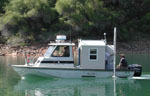 Frontier |  on foot |
| Survey Equipment | Survey Info | Data Type(s) | Data Collected |
|---|---|---|---|
| Push corer | --- | Chemistry Surveys (geochemical) Surveys (biological) Biology Geology | grainsize analysis (published in ScienceBase; U.S. Geological Survey data release, doi: 10.5066/F7S75DG9) |
| CTD | --- | Surveys (geochemical) Experiments (geochemical) CTD | |
| watersamples | --- | Conductivity CTD Dissolved Oxygen Fluorescence Nitrate pH Temperature Turbidity Wave | |
| CT | --- | Conductivity Temperature | |
| turbiditymeter | --- | Turbidity | |
| OBS | --- | Sediment Properties Turbidity Biology Chemistry Geology | |
| Nutrient sampler | --- | Chlorophyll Nutrients | |
| navigation | --- | Navigation | |
| water bottle | --- | Surveys (biological) Biology Chemistry | |
| Moorings - Tripods | --- | Mooring (physical oceanography) |
