AKA: CCE
Other ID: none
Status: Completed
Organization(s): Other, USGS, Pacific Coastal and Marine Science Center
Funding Program(s): Other (Other), Sediment Transport in Coastal Environments (ZP00FDB)
Principal Investigator(s): Katherine Coble, Joanne Thede, Kurt Rosenberger
Affiliate Investigator(s): Charles K. Paull (MBARI)
Information Specialist(s): Katherine Coble, Joanne Thede, Kurt Rosenberger
Data Type(s): Location-Elevation: Navigation, Time Series: Mooring (physical oceanography)
Scientific Purpose/Goals: Coordinated Canyon Experiment - turn-around of moorings (MS1, 2, & 3) in the upper canyon
Vehicle(s): MarFac; Mac Semi G82-0099N, MarFac; Ford 650 Box truck - White G71-03559
Start Port/Location: Moss Landing, CA
End Port/Location: Moss Landing, CA
Start Date: 2016-10-03
End Date: 2016-10-07
Equipment Used: navigation equipment, Other
Information to be Derived: Turn-around of three moorings in upper Monterey Canyon as part of the CCE
Summary of Activity and Data Gathered: Data and mooring logs submitted to FAD 5/23/2017 by Kurt Rosenberger We successfully recovered data from three moorings in upper Monterey Canyon (MS1, MS2, MS3) on October 3, 2016. We redeployed these three moorings on October 6, 2016.
Staff: Katherine Coble, Joanne Thede, Cordell Johnson, Daniel Powers, Kurt Rosenberger
Affiliate Staff:
Notes: This is a joint field operation with MBARI as part of the Coordinated Canyon Experiment (CCE).
Entries for this field activity are based on entries from Field Activity 2016-610-FA
Location:
Monterey Canyon, Monterey Bay, California, United States, Pacific Ocean
| Boundaries | |||
|---|---|---|---|
| North: 36.8408706 | South: 36.73227062 | West: -121.977 | East: -121.81406555 |
Platform(s):
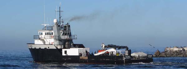
 Rachel Carson (MBARI) |
Ferreira, J.T., Rosenberger, K.J., and Maier, K.L., 2019, Time-series oceanographic data from the Monterey Canyon, CA October 2015 - March 2017: U.S. Geological Survey data release.
| Survey Equipment | Survey Info | Data Type(s) | Data Collected |
|---|---|---|---|
| navigation equipment | --- | Navigation | |
| Other | --- | --- | --- |