Other ID: PC-17-05 (OMAO)
Status: Completed
Organization(s): USGS, Woods Hole Coastal and Marine Science Center, National Oceanic and Atmospheric Administration, Woods Hole Oceanographic Institution
Funding Program(s):
Principal Investigator(s): Jason Chaytor
Affiliate Investigator(s): WHOI-Sentry: Sean Kelley, Michael Jakuba, Ian Vaughn, Andrew Billings, Jennifer Vaccaro; Temple University: Alanna Durkin; NOAA: Caitlin Adams; USGS Wetland and Aquatic Research Center: Jennifer McClain-Counts
Information Specialist(s): Brian Andrews
Data Type(s): Sonar: Sidescan, Environmental Data: CTD, Sampling: Geology, Imagery: Photo, Seismics: Sub Bottom Profiler, Sonar: Multibeam
Scientific Purpose/Goals: Deepwater Atlantic Habitats II: Continued Atlantic Research and Exploration in Deepwater Ecosystems with Focus on Coral, Canyon, and Seep Communities
Vehicle(s):
Start Port/Location: Norfolk, VA
End Port/Location: Norfolk, VA
Start Date: 2017-09-12
End Date: 2017-09-22
Equipment Used: Reson 7125, Digital camera, Knudsen 3260, Simrad ME70, Edgetech 2200M-sidescan, Edgetech 2200M-subbottom, CTD - generic, Microcorer
Information to be Derived: Bathymetry, sediment thickness, outcrop mapping
Summary of Activity and Data Gathered: This cruise was visited by two different Hurricanes (José and Maria). Original departure port (Morehead City, NC) was moved to Norfolk, VA and departure date was moved from 11 Sep to 12 Sep. Rode out Hurricane José in Morehead City, NC 16-19 Sept. Cruise was terminated on 22 Sept (6 days early) because of approaching of Hurricane Maria. Complete Cruise details available from NOAA OE website for Cruise https://oceanexplorer.noaa.gov/explorations/17deepsearch/welcome.html. NOAA Survey ID = PC-17-05 Total Ship Trackline=1,200 kms Pisces bathymetry (ME-70) =44 km Pisces seismic profile (Knudsen 3260)= 800kms Sentry Dives=3 Sentry bathymetry (Reson 7125)=145 kms (depth and backscatter) Sentry sidescan seismic profiles (EdgeTech 2200M)-145 kms Sentry--continuous bottom photographs CTDs=7 6 sediment samples from monocore on CTD
Staff: Brian Andrews, Amanda Demopolous
Affiliate Staff:
Notes: Multibeam data (depth,backscatter,water column) will be collected via Simrad ME 70 hull mounted sonar on NOAA Ship Pisces. In addtion AUV Sentry (WHOI) will collect same multibeam data with a Reson 7125 sonar. Chirp SBP collected via Setnry AUV. Imagery from AUV.
Mission Overview on NOAA OER website:
https://oceanexplorer.noaa.gov/explorations/17deepsearch/welcome.html
Location:
Mid- and Southern US Atlantic margin
| Boundaries | |||
|---|---|---|---|
| North: 35.9709274 | South: 32.1920803 | West: -78.3700022 | East: -74.7041098 |
Platform(s):
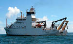 Pisces |  Sentry (AUV) |
Prouty, N.G., and Baker, M.C., 2021, Water-column environmental variables and accompanying discrete CTD measurements collected offshore the U.S. Mid- and South Atlantic (ver. 2.0, July 2022): U.S. Geological Survey data release, https://doi.org/10.5066/P9K2GOAL.
| Survey Equipment | Survey Info | Data Type(s) | Data Collected |
|---|---|---|---|
| Reson 7125 | --- | Multibeam | |
| Digital camera | --- | Photo | |
| Knudsen 3260 | --- | Sub Bottom Profiler | |
| Simrad ME70 | --- | Water column reflectivity Multibeam | |
| Edgetech 2200M-sidescan | --- | Sidescan | |
| Edgetech 2200M-subbottom | --- | Sub Bottom Profiler | |
| CTD - generic | --- | CTD | |
| Microcorer | --- | Geology |
