AKA: none
Other ID: none
Status: Completed
Organization(s): Other, USGS, Pacific Coastal and Marine Science Center
Funding Program(s): Coastal and marine earthquake, tsunami, and landslide active margin field studies (ZP00EQV)
Principal Investigator(s): Daniel Brothers, Janet Watt
Affiliate Investigator(s): Brian Sherrod, USGS Seattle; Scott Bennett, USGS Seattle; Emily Roland, University of Washington
Information Specialist(s): Janet Watt
Data Type(s): Location-Elevation: Navigation, Seismics: Boomer, Seismics: Multichannel, Seismics: Sparker, Seismics: Sub Bottom Profiler
Scientific Purpose/Goals: Characterize recent deformation and estimate earthquake recurrence on the Seattle Fault zone
Vehicle(s): MarFac; Ford 650 Box truck - White G71-03559
Start Port/Location: Seattle, WA
End Port/Location: Seattle, WA
Start Date: 2017-02-18
End Date: 2017-02-28
Equipment Used: Other, Other, Multichannel, 512 chirp-source, 512 chirp, Mini sparker
Information to be Derived: MCS sparker, MCS boomer, chirp sub-bottom
Summary of Activity and Data Gathered: Data submitted to FAD 3/7/2017 We collected multi-channel sparker and towed chirp sub-bottom data in Puget Sound and multi-channel boomer and towed chirp sub-bottom data in Lake Washington
Staff: Rachel Marcuson, Robert Wyland
Affiliate Staff:
Notes: R/V Barnes, UW vessel
Working with USGS Earthquake Science Center in Seattle, WA and Univ. of Washington faculty (Emily Roland)
Location:
Puget Sound, Washington
| Boundaries | |||
|---|---|---|---|
| North: 48.10412981 | South: 47.20861616 | West: -122.85736084 | East: -122.11712646 |
Platform(s):
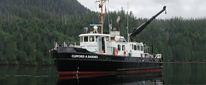 Clifford A. Barnes |
Balster-Gee, A.F., Watt, J.T., Roland, E.C., Kluesner, J.W., Brothers, D.S., Bennett, S., Hart, P.E., Myers, E.K., Pszczola, K., Walton, M.A.L., and Sherrod, B., 2021, Multichannel minisparker, multichannel boomer, and chirp seismic-reflection data of USGS field activity 2017-612-FA collected in Puget Sound and Lake Washington in February of 2017: U.S. Geological Survey data release, https://doi.org/10.5066/P9GWF28U.
| Survey Equipment | Survey Info | Data Type(s) | Data Collected |
|---|---|---|---|
| Other | --- | --- | --- |
| Other | --- | --- | --- |
| Multichannel | --- | Multichannel | Multichannel boomer data (High-resolution multichannel boomer seismic-reflection data were collected by the U.S. Geological Survey and the University of Washington in February of 2017 east of Seattle in Lake Washington, Washington.) Multichannel minisparker data (High-resolution multichannel minisparker seismic-reflection data were collected by the U.S. Geological Survey and the University of Washington in February of 2017 west of Seattle in Puget Sound and in Lake Washington, Washington. ) |
| 512 chirp-source | --- | Sub Bottom Profiler | |
| 512 chirp | --- | Sub Bottom Profiler | Chirp sub-bottom data (High-resolution chirp sub-bottom data were collected by the U.S. Geological Survey and the University of Washington in February of 2017 west of Seattle in Puget Sound and in Lake Washington, Washington.) |
| Mini sparker | --- | Sparker |
