AKA: none
Other ID: none
Status: Completed
Organization(s): USGS, Pacific Coastal and Marine Science Center
Funding Program(s): Past, Present and Future Coral Reefs (ZP00FRV)
Principal Investigator(s): Curt Storlazzi
Affiliate Investigator(s): Lowe, Ryan (UWA); Hansen, Jeff (UWA); Pomeroy, Andrew (UWA)
Information Specialist(s): Joshua Logan
Data Type(s): Imagery: Photo, Imagery: Video, Location-Elevation: Navigation, Sampling: Geology, Time Series: Mooring (physical oceanography)
Scientific Purpose/Goals: Determine controls on sediment transport from the fore reef to the shoreline.
Vehicle(s): None
Start Port/Location: Kaunakakai, Molokai, HI
End Port/Location: Kaunakakai, Molokai, HI
Start Date: 2018-06-18
End Date: 2018-06-27
Equipment Used: Structure from Motion - UAS, instrumentmooring, RTK GPS, HD video camera system, Push corer
Information to be Derived: tide, wave height, wave period, wave direction, current speed, current direction, optical backscatter, acoustic backscatter, imagery.
Summary of Activity and Data Gathered: argus files submitted by Shawn Harrison 8/29/2018
Staff:
Affiliate Staff:
Notes: argus file update 9/6/2018
Location:
South Molokai, Hawaii
| Boundaries | |||
|---|---|---|---|
| North: 21.10437892 | South: 21.06947819 | West: -157.19755503 | East: -157.12607593 |
Platform(s):
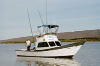
 Alyce C |
Buckley, M.L., Buscombe, D., Birchler, J.J., Palmsten, M.L., Swanson, E., Brown, J.A., Itzkin, M., Storlazzi, C.D., Harrison, S.R., 2024, Wave runup and total water level observations from time series imagery at several sites with varying nearshore morphologies: Coastal Engineering, v. 193, 104600 p., doi: 10.1016/j.coastaleng.2024.104600.
Harrison, S.R., Buckley, M.L., Logan, J., Pomeroy, A.W.M., Storlazzi, C.D., Birchler, J.J., Palmsten, M.L., Swanson, E., Johnson, E.L., 2024, USGS CoastCam at WaiakÄne, Moloka'i, Hawai'i: 2018 Calibration and GNSS Topography Survey Data: U.S. Geological Survey data release, https://doi.org/10.5066/P13XN6KM.
Harrison, S.R., Buckley, M.L., Logan, J., Pomeroy, A.W.M., Storlazzi, C.D., Birchler, J.J., Palmsten, M.L., Swanson, E., Johnson, E.L., 2024, USGS CoastCam at WaiakÄne, Moloka'i, Hawai'i: 2018 Timestack Imagery and Coordinate Data: U.S. Geological Survey data release, https://doi.org/10.5066/P14QO72F.
Logan, J.B., and Storlazzi, C.D., 2022, Aerial imagery and structure-from-motion-derived shallow water bathymetry from a UAS survey of the coral reef off Waiakane, Molokai, Hawaii, June 2018: U.S. Geological Survey data release, https://doi.org/10.5066/P9XZT1FK.
Rosenberger, K.J., Cheriton, O.M., and Storlazzi, C.D., 2020, Cross-reef wave and water level data from coral reef environments: U.S. Geological Survey data release, https://doi.org/10.5066/P9RYN5NH.
Rosenberger, K.J., Storlazzi, C.D., Cheriton, O.M., and Logan, J.B., 2019, Waiakane, Molokai, HI, 2018 Coral Reef Circulation and Sediment Dynamics Experiment: U.S. Geological Survey data release, https://doi.org/10.5066/P9FSG90O.
| Survey Equipment | Survey Info | Data Type(s) | Data Collected |
|---|---|---|---|
| Structure from Motion - UAS | --- | Photo | 3D bathymetric surfaces of low- and high-relief sites (3D bathymetric surfaces of low- and high-relief sites from the coral reef flat off Waiakane, Molokai, were created using structure-from-motion (SfM) techniques.) Ground control point locations for the UAS survey (This portion of the data release presents the locations of the temporary ground control points (GCPs) used for the structure-from-motion (SfM) processing of the imagery collected during an unoccupied aerial system (UAS) survey of the coral reef off Waiakane, Molokai, Hawaii, on 24 June 2018. The GCP positions are presented in a comma-delimited text file.) Orthomosaic imagery from the UAS survey (This portion of the data release presents a high-resolution orthomosaic image of the coral reef off Waiakane, Molokai, Hawaii. The orthomosaic has a resolution of 2.5 centimeters (cm) per pixel and was derived from structure-from-motion (SfM) processing of aerial imagery collected with an unoccupied aerial system (UAS) on 24 June 2018. ) Refraction-corrected bathymetric point cloud from the UAS survey (This portion of the data release presents a bathymetric point cloud from an unoccupied aerial system (UAS) survey of the coral reef off Waiakane, Molokai, Hawaii, on 24 June 2018.) Refraction-corrected bathymetric digital surface model (DSM) from the UAS survey (This portion of the data release presents a bathymetric digital surface model (DSM) from an unoccupied aerial system (UAS) survey of the coral reef off Waiakane, Molokai, Hawaii, on 24 June 2018.) UAS (Digital images and products from UAS SfM survey. Archived on FAD.) |
| instrumentmooring | --- | Geology Mooring (physical oceanography) | West Maui, Hawaiian Islands, wave and water level data, 2017 (Time series data of wave height and water surface elevation were acquired at ten locations for 75 days south of Lahaina, off of the west coast of the island of Maui, Hawaii, in support of a study on the coastal circulation patterns and the transformation of surface waves over the coral reefs.) Waiakane, Molokai, Hawaiian Islands, wave and water level data, 2018 (Time series data of water surface elevation, wave height, and water column currents and temperature were acquired at seven locations for 86 days off of Waiakane on the south coast of the island of Molokai, Hawaii, in support of a study on the coastal circulation patterns and the transformation of surface waves over the coral reefs. ) Time-series oceanographic data of currents and waves from bottom-mounted instrument packages off Waiakane, Molokai, HI, 2018 (Time series data of water surface elevation, wave height, and water column currents and temperature were acquired at seven locations for 86 days off of Waiakane on the south coast of the island of Molokai, Hawaii, in support of a study on the coastal circulation patterns and the transformation of surface waves over the coral reefs.) |
| RTK GPS | --- | LIDAR Transects Benchmarks Profiles Navigation | MolokaiHI_XYZ_20180626 (Post-processed GNSS ground-survey data) |
| HD video camera system | --- | Video | MolokaiHI_c2_20180625_IO (Images to solve camera intrinsic orientation along with solved parameters ) MolokaiHI_c2_20180626_EO (Images to solve camera extrinsic orientation (raw and annotated) along with solved parameters and Ground Control Point (GCP) data ) MolokaiHI_c2_20180625_ calibrationIOEO_ exampleImagery (Example imagery used to solve intrinsic and extrinsic parameters) |
| Push corer | --- | Surveys (geochemical) Surveys (biological) Biology Geology |