AKA: none
Other ID: EW0407,E-1-04-SC
Status: Completed
Organization(s): Lamont Doherty Earth Observatory
Funding Program(s):
Principal Investigator(s): Guy Cochrane, Peter Dartnell
Affiliate Investigator(s):
Information Specialist(s): Peter Dartnell
Data Type(s): Sonar: Sidescan, Sonar: Single Beam
Scientific Purpose/Goals: Swath bathymetry of Southern California shelf.
Vehicle(s):
Start Port/Location:
End Port/Location: 06, 2004 - San Diego, CA and 15, 2004 - Port Hueneme, CA
Start Date: 2004-08-06
End Date: 2004-08-15
Equipment Used: bathymetry, sidescansonar
Information to be Derived:
Summary of Activity and Data Gathered:
Staff:
Affiliate Staff:
Notes: For raw and intermediate data sets, contact Rani Nandiwada
Staff information imported from InfoBank
Guy Cochrane (USGS Menlo Park) - Chief Scientist
Pete Dartnell (USGS Menlo Park) - Chief Scientist
Location:
Southern California shelf
| Boundaries | |||
|---|---|---|---|
| North: 34.34 | South: 33.85 | West: -119.625 | East: -119.05 |
Platform(s):
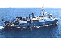 Maurice Ewing |
Dartnell, P., and Cochrane, G.R., 2016, High-resolution multibeam bathymetry and backscatter data collected in 2004 for the northern Channel Islands region, southern California: U.S. Geological Survey Data release.
Dartnell, P., Cochrane, G., and Dunaway, M.E., 2005, Multibeam Bathymetry and Backscatter Data: Northeastern Channel Islands Region, Southern California: U.S. Geological Survey Open-File Report 2005-1153, http://pubs.usgs.gov/of/2005/1153/.
Dartnell, P., Roland, E.C., Raineault, N.A., Castillo, C.M., Conrad, J.E., Kane, R.R., Brothers, D.S., Kluesner, J.W., and Walton, M.A.L., 2017, Multibeam bathymetry and acoustic-backscatter data collected in 2016 in Catalina Basin, southern California and merged multibeam bathymetry datasets of the northern portion of the Southern California Continental Borderland: U.S. Geological Survey data release, https://doi.org/10.5066/F7DV1H3W.
| Survey Equipment | Survey Info | Data Type(s) | Data Collected |
|---|---|---|---|
| bathymetry | --- | Single Beam | south area bathy 5m (published on Sciencebase doi: 10.5066/F7S46Q1J) north area backscatter_5m (published on Sciencebase; U.S. Geological Survey data release, doi: 10.5066/F7S46Q1J) northArea_bathy_5m (data published on Sciencebase doi: 10.5066/F7S46Q1J.) ArcInfo GRID format of the 2004 Multibeam Bathymetry Data in the Northeastern Channel Islands Region, Southern California [bathy.zip] (ArcInfo GRID format data generated from the 2004 multibeam sonar survey of the Northeastern Channel Islands, CA Region. The data include high-resolution bathymetry.) south area backscatter 5m (published on Sciencebase doi: 10.5066/F7S46Q1J) |
| sidescansonar | --- | Sidescan | ArcInfo GRID format of the 2004 Multibeam Backscatter Data in the Northeastern Channel Islands Region, Southern California [mos.zip] (ArcInfo GRID format data generated from the 2004 multibeam sonar survey of the Northeastern Channel Islands, CA Region. The data include high-resolution, acoustic, corrected backscatter.) |
