USGS > Coastal and Marine Hazards and Resources Program > Coastal and Marine Geoscience Data System
Field Activity 12BIM03 Images of SEGY Data
JPEG images of seismic data labeled by line numbers
Click on an image to download the full size JPG file.
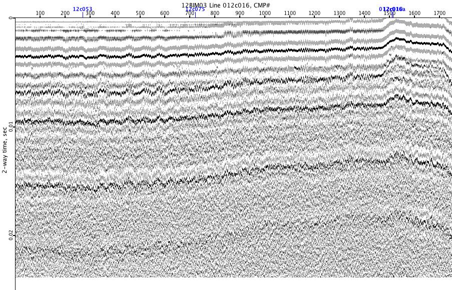
12BIM03-012c016
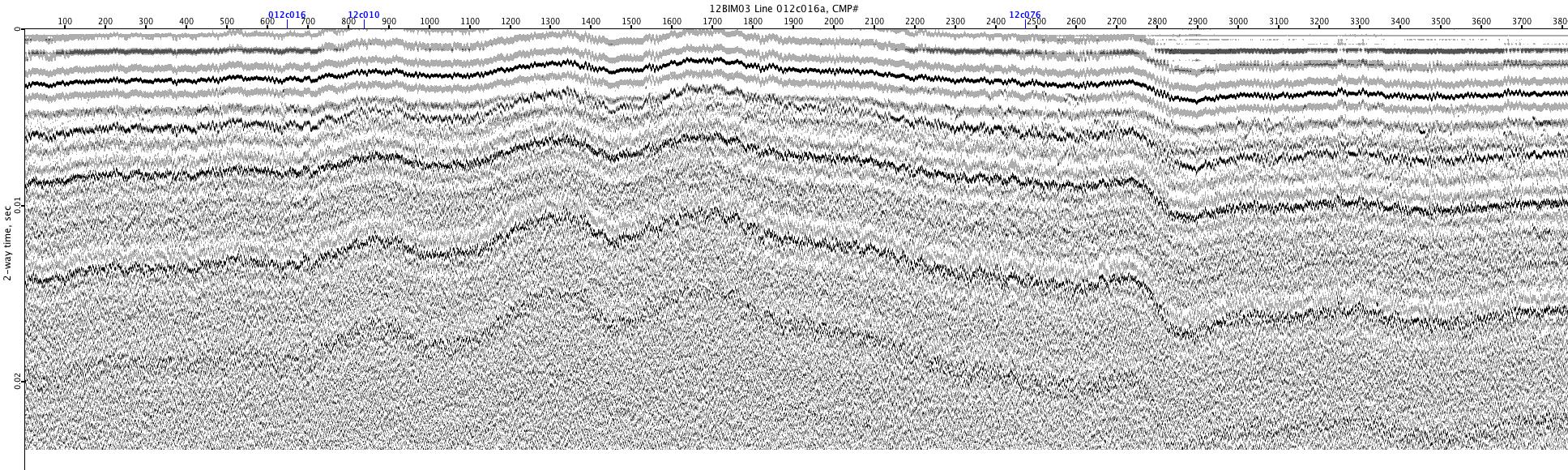
12BIM03-012c016a
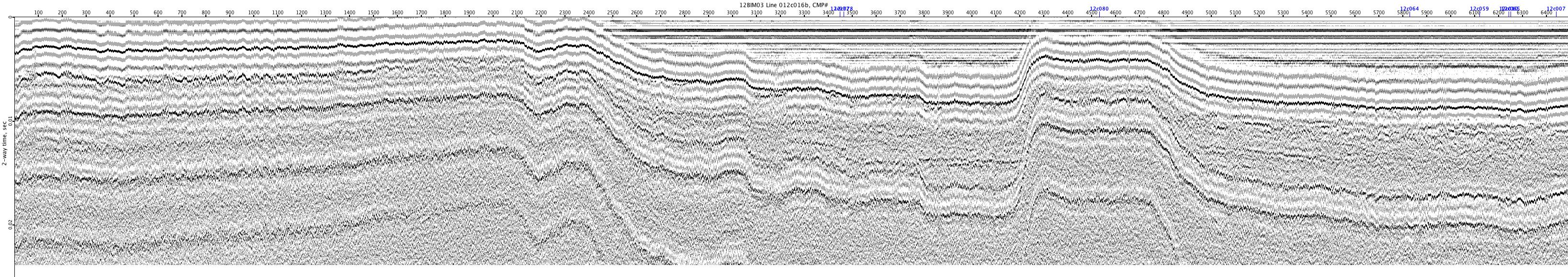
12BIM03-012c016b
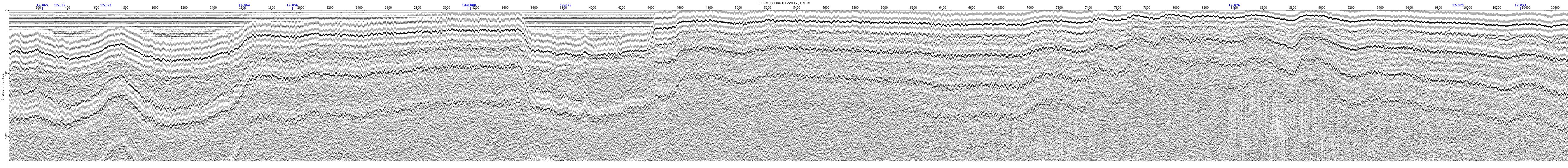
12BIM03-012c017
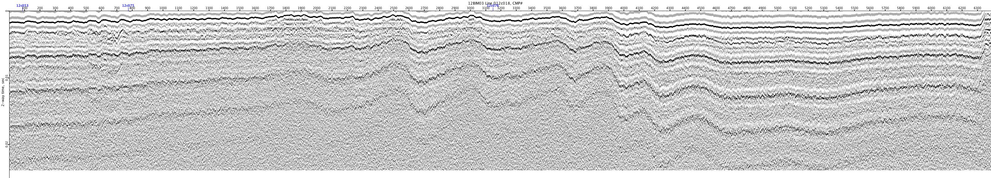
12BIM03-012c018
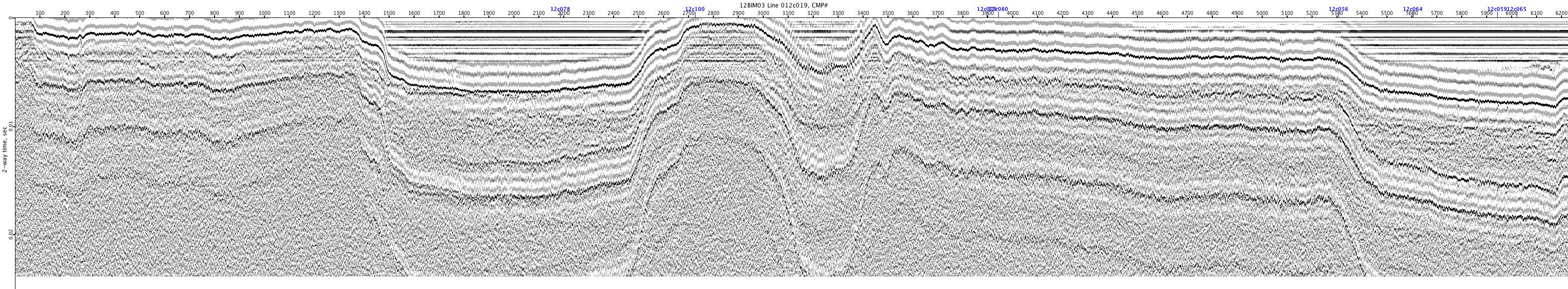
12BIM03-012c019
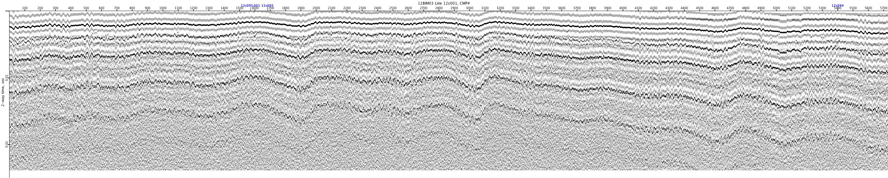
12BIM03-12c001
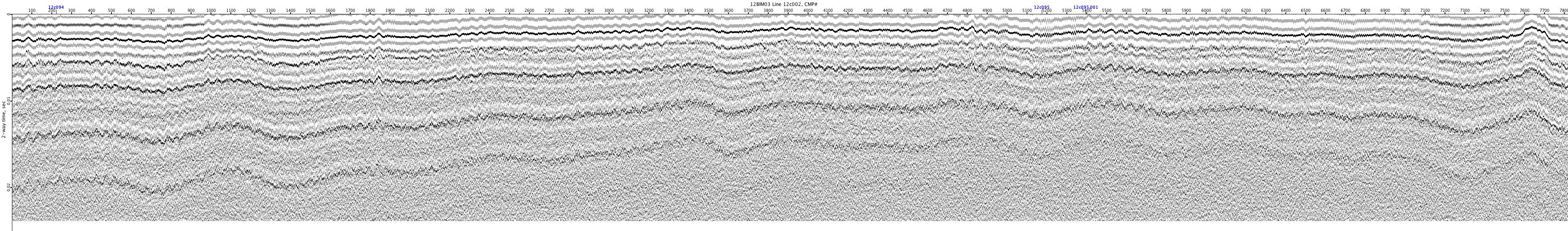
12BIM03-12c002
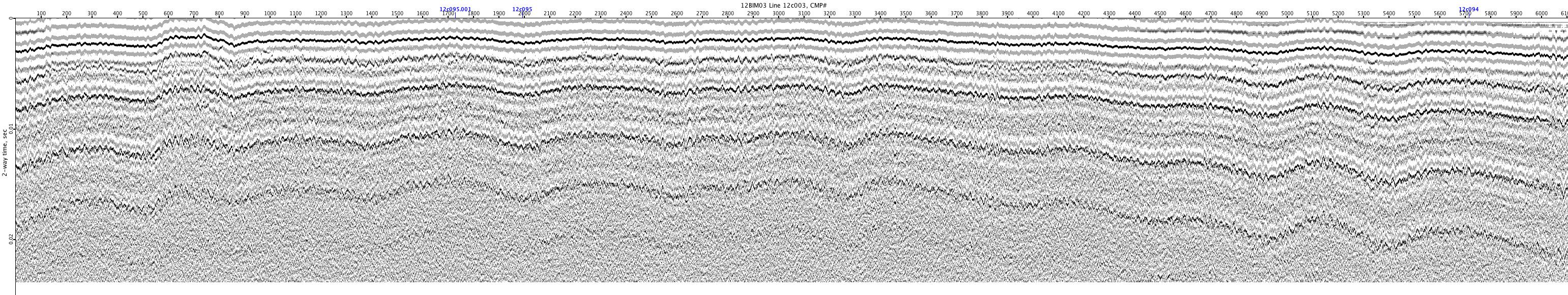
12BIM03-12c003
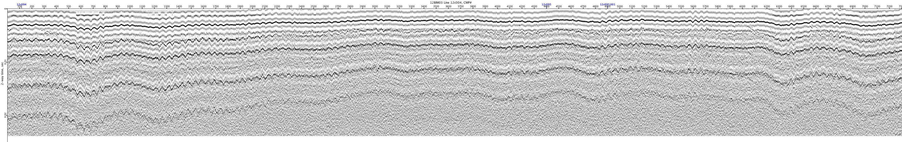
12BIM03-12c004
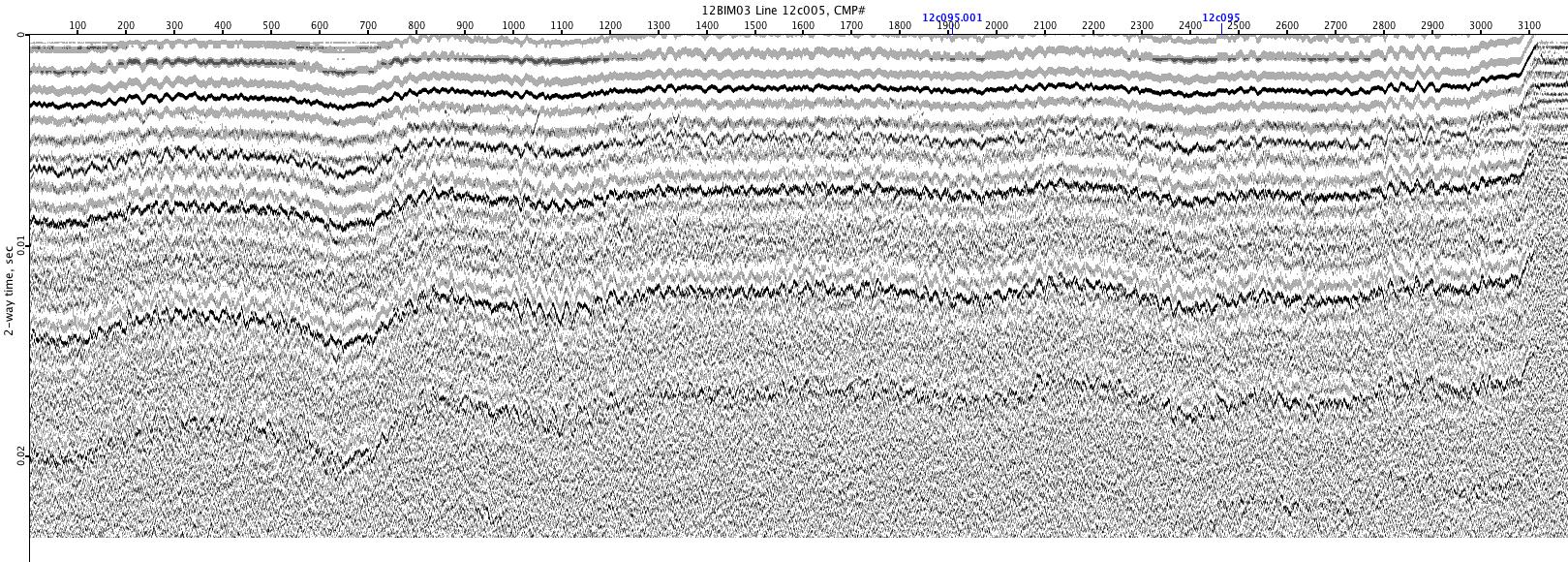
12BIM03-12c005
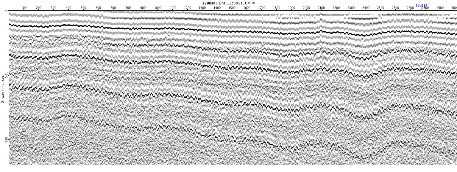
12BIM03-12c005a
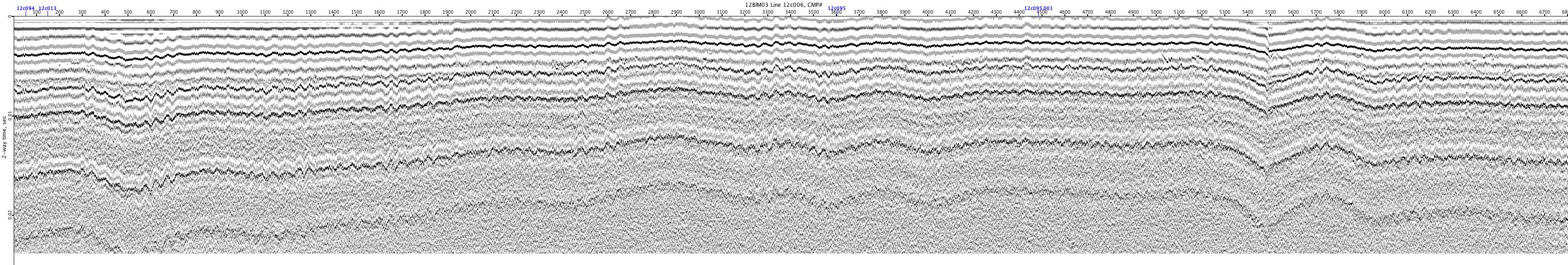
12BIM03-12c006
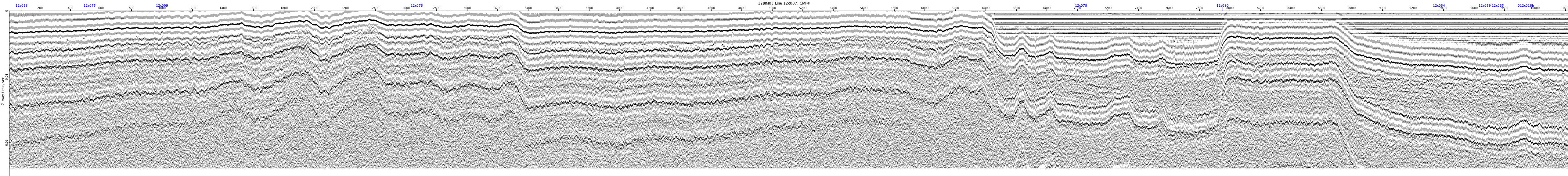
12BIM03-12c007
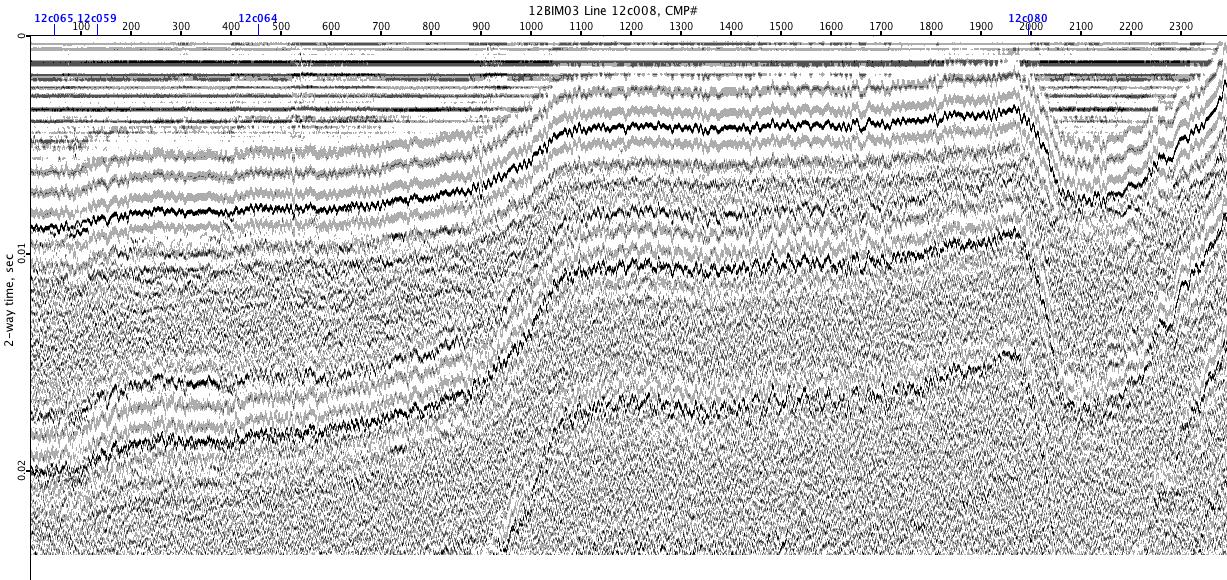
12BIM03-12c008
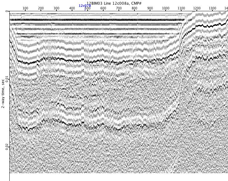
12BIM03-12c008a
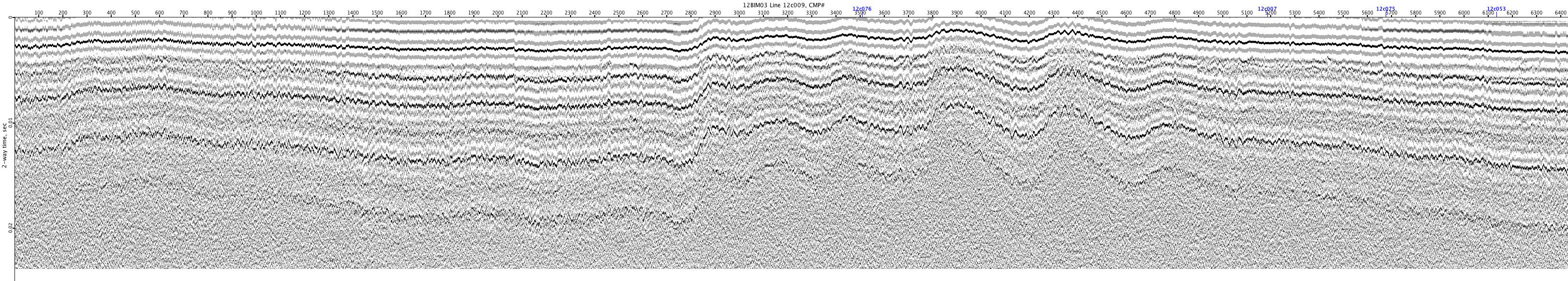
12BIM03-12c009
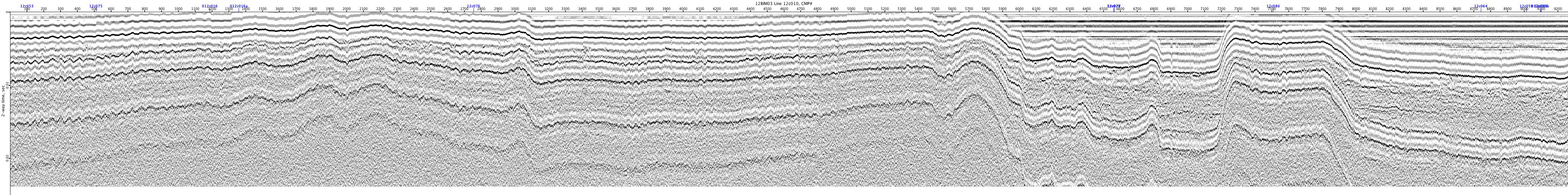
12BIM03-12c010
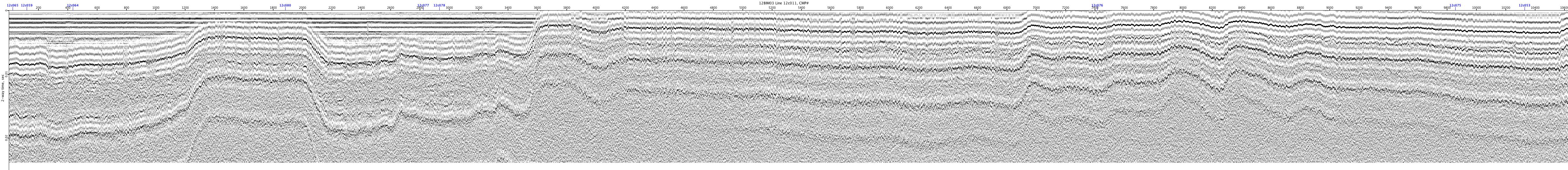
12BIM03-12c011
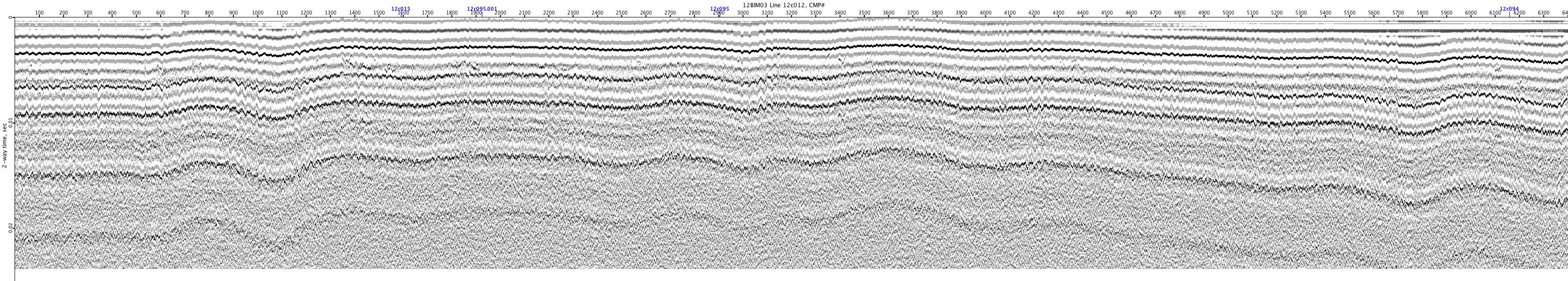
12BIM03-12c012
