AKA: none
Other ID: none
Organization(s): USGS, Pacific Coastal and Marine Science Center
Funding Program(s): Coastal and marine earthquake, tsunami, and landslide active margin field studies (ZP00EQV), Marine Geomorphology, Evolution, and Habitats (ZP00FE6)
Principal Investigator(s): Samuel Johnson
Affiliate Investigator(s):
Data Type(s): Electro-Magnetic: Magnetics, Location-Elevation: Navigation, Seismics: Sparker
Start Date: 2014-07-17
End Date: 2014-08-02
Equipment Used: Magnetometer, CodaOctopus F190, Mini sparker, single channel streamer
Information to be Derived: Fault maps, sediment thickness maps, geologic maps
Summary of Activity and Data Gathered: Magnetics and SGY data on FAD. Collected minisparker seismic-reflection and marine magnetometer data. Successful cruise
Staff: Alicia Balster-gee, James Conrad, Jackson Currie, Stephen Hartwell, Gerry Hatcher, Robert Wyland, Other
Affiliate Staff:
Location:
Central California, Gaviota to Point Sal
| Boundaries | |||
|---|---|---|---|
| North: 34.95349314 | South: 34.33075946 | West: -120.943 | East: -120.15743583 |
Platform(s):
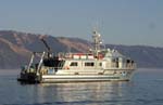 Shearwater |
