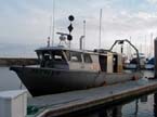
AKA: none
Other ID: Z-3-07-SC
Organization(s): USGS, Pacific Coastal and Marine Science Center
Funding Program(s):
Principal Investigator(s):
Affiliate Investigator(s):
Data Type(s): Location-Elevation: Navigation, Seismics: Boomer, Seismics: Sparker
Start Date: 2007-09-12
End Date: 2007-09-27
Equipment Used: Chirp, GPS, minisparker
Information to be Derived:
Summary of Activity and Data Gathered:
Staff:
Affiliate Staff:
Location:
Santa Barbara Channel
| Boundaries | |||
|---|---|---|---|
| North: 34.44022 | South: 34.01825 | West: -120.012 | East: -119.05539 |
Platform(s):
 Zephyr |